You are here: Home > Network List > CI - Caltech Regional Seismic Network Stations List
> Station MPM Manuel Prospect Mine, California, USA > Earthquake Result Viewer
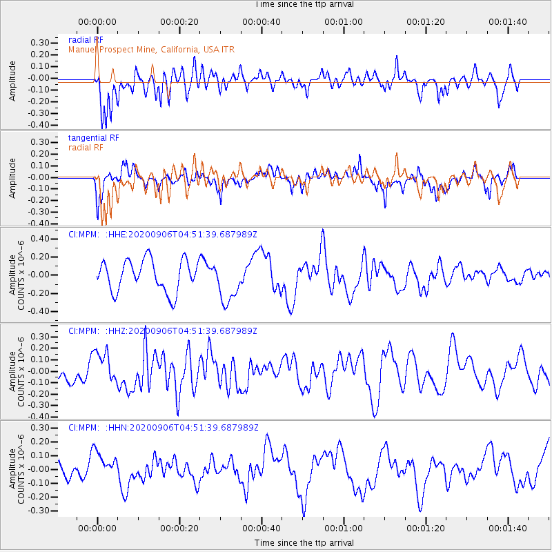
MPM Manuel Prospect Mine, California, USA - Earthquake Result Viewer
*The percent match for this event was below the threshold and hence no stack was calculated.
| Earthquake location: |
Vanuatu Islands |
| Earthquake latitude/longitude: |
-17.1/167.8 |
| Earthquake time(UTC): |
2020/09/06 (250) 04:39:20 GMT |
| Earthquake Depth: |
10 km |
| Earthquake Magnitude: |
5.4 Mww |
| Earthquake Catalog/Contributor: |
NEIC PDE/us |
|
| Network: |
CI Caltech Regional Seismic Network |
| Station: |
MPM Manuel Prospect Mine, California, USA |
| Lat/Lon: |
36.06 N/117.49 W |
| Elevation: |
185 m |
|
| Distance: |
88.1 deg |
| Az: |
51.445 deg |
| Baz: |
247.338 deg |
| Ray Param: |
$rayparam |
*The percent match for this event was below the threshold and hence was not used in the summary stack. |
|
| Radial Match: |
62.24585 % |
| Radial Bump: |
400 |
| Transverse Match: |
60.23706 % |
| Transverse Bump: |
400 |
| SOD ConfigId: |
22732711 |
| Insert Time: |
2020-09-20 04:44:22.443 +0000 |
| GWidth: |
2.5 |
| Max Bumps: |
400 |
| Tol: |
0.001 |
|
Signal To Noise
| Channel | StoN | STA | LTA |
| CI:MPM: :HHZ:20200906T04:51:39.687989Z | 0.9120262 | 1.4064372E-7 | 1.5421017E-7 |
| CI:MPM: :HHN:20200906T04:51:39.687989Z | 0.9855518 | 1.0103726E-7 | 1.0251847E-7 |
| CI:MPM: :HHE:20200906T04:51:39.687989Z | 1.406837 | 2.4225335E-7 | 1.7219718E-7 |
| Arrivals |
| Ps | |
| PpPs | |
| PsPs/PpSs | |


