You are here: Home > Network List > TA - USArray Transportable Network (new EarthScope stations) Stations List
> Station M16K Timber Creek, AK, USA > Earthquake Result Viewer
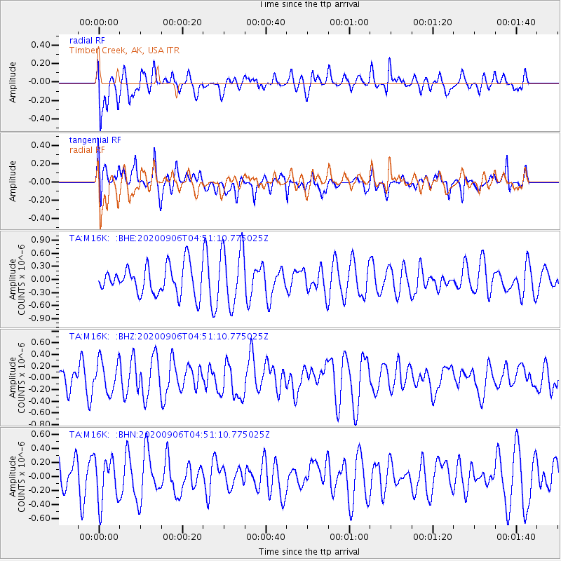
M16K Timber Creek, AK, USA - Earthquake Result Viewer
*The percent match for this event was below the threshold and hence no stack was calculated.
| Earthquake location: |
Vanuatu Islands |
| Earthquake latitude/longitude: |
-17.1/167.8 |
| Earthquake time(UTC): |
2020/09/06 (250) 04:39:20 GMT |
| Earthquake Depth: |
10 km |
| Earthquake Magnitude: |
5.4 Mww |
| Earthquake Catalog/Contributor: |
NEIC PDE/us |
|
| Network: |
TA USArray Transportable Network (new EarthScope stations) |
| Station: |
M16K Timber Creek, AK, USA |
| Lat/Lon: |
61.02 N/158.96 W |
| Elevation: |
394 m |
|
| Distance: |
82.3 deg |
| Az: |
15.622 deg |
| Baz: |
211.923 deg |
| Ray Param: |
$rayparam |
*The percent match for this event was below the threshold and hence was not used in the summary stack. |
|
| Radial Match: |
54.687485 % |
| Radial Bump: |
400 |
| Transverse Match: |
42.490395 % |
| Transverse Bump: |
400 |
| SOD ConfigId: |
22732711 |
| Insert Time: |
2020-09-20 04:48:56.048 +0000 |
| GWidth: |
2.5 |
| Max Bumps: |
400 |
| Tol: |
0.001 |
|
Signal To Noise
| Channel | StoN | STA | LTA |
| TA:M16K: :BHZ:20200906T04:51:10.775025Z | 1.5700159 | 2.7788826E-7 | 1.769971E-7 |
| TA:M16K: :BHN:20200906T04:51:10.775025Z | 1.330749 | 3.184895E-7 | 2.3933097E-7 |
| TA:M16K: :BHE:20200906T04:51:10.775025Z | 2.0694342 | 6.762963E-7 | 3.2680254E-7 |
| Arrivals |
| Ps | |
| PpPs | |
| PsPs/PpSs | |


