You are here: Home > Network List > UU - University of Utah Regional Network Stations List
> Station WPUT Wasatch Plateau, UT,USA > Earthquake Result Viewer
WPUT Wasatch Plateau, UT,USA - Earthquake Result Viewer

| Earthquake location: |
Central Mid-Atlantic Ridge |
| Earthquake latitude/longitude: |
7.7/-37.2 |
| Earthquake time(UTC): |
2020/09/06 (250) 06:51:19 GMT |
| Earthquake Depth: |
10 km |
| Earthquake Magnitude: |
6.7 Mww |
| Earthquake Catalog/Contributor: |
NEIC PDE/us |
|
| Network: |
UU University of Utah Regional Network |
| Station: |
WPUT Wasatch Plateau, UT,USA |
| Lat/Lon: |
39.00 N/111.36 W |
| Elevation: |
2618 m |
|
| Distance: |
72.9 deg |
| Az: |
308.341 deg |
| Baz: |
93.967 deg |
| Ray Param: |
0.053382065 |
| Estimated Moho Depth: |
18.25 km |
| Estimated Crust Vp/Vs: |
1.60 |
| Assumed Crust Vp: |
6.207 km/s |
| Estimated Crust Vs: |
3.879 km/s |
| Estimated Crust Poisson's Ratio: |
0.18 |
|
| Radial Match: |
88.37734 % |
| Radial Bump: |
400 |
| Transverse Match: |
72.622665 % |
| Transverse Bump: |
400 |
| SOD ConfigId: |
22732711 |
| Insert Time: |
2020-09-20 07:28:50.429 +0000 |
| GWidth: |
2.5 |
| Max Bumps: |
400 |
| Tol: |
0.001 |
|
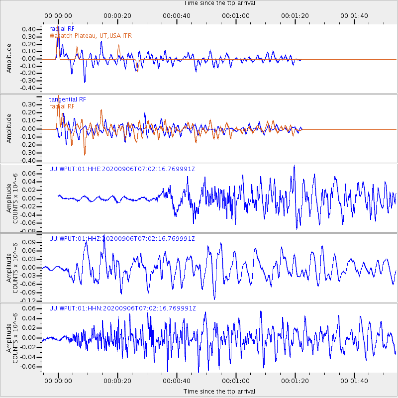
Signal To Noise
| Channel | StoN | STA | LTA |
| UU:WPUT:01:HHZ:20200906T07:02:16.769991Z | 3.7870324 | 1.4715162E-8 | 3.8856713E-9 |
| UU:WPUT:01:HHN:20200906T07:02:16.769991Z | 1.1926764 | 3.2511442E-9 | 2.7259233E-9 |
| UU:WPUT:01:HHE:20200906T07:02:16.769991Z | 1.0324016 | 4.153954E-9 | 4.023584E-9 |
| Arrivals |
| Ps | 1.8 SECOND |
| PpPs | 7.4 SECOND |
| PsPs/PpSs | 9.2 SECOND |


