You are here: Home > Network List > GS - US Geological Survey Networks Stations List
> Station MT03 Stemple Pass Rd, Helena Natl Forest, Montana, USA > Earthquake Result Viewer
MT03 Stemple Pass Rd, Helena Natl Forest, Montana, USA - Earthquake Result Viewer

| Earthquake location: |
Northern Xinjiang, China |
| Earthquake latitude/longitude: |
44.3/82.8 |
| Earthquake time(UTC): |
2017/08/08 (220) 23:27:53 GMT |
| Earthquake Depth: |
20 km |
| Earthquake Magnitude: |
6.3 Mww |
| Earthquake Catalog/Contributor: |
NEIC PDE/us |
|
| Network: |
GS US Geological Survey Networks |
| Station: |
MT03 Stemple Pass Rd, Helena Natl Forest, Montana, USA |
| Lat/Lon: |
46.91 N/112.50 W |
| Elevation: |
2025 m |
|
| Distance: |
88.2 deg |
| Az: |
10.45 deg |
| Baz: |
349.05 deg |
| Ray Param: |
0.042774823 |
| Estimated Moho Depth: |
37.5 km |
| Estimated Crust Vp/Vs: |
1.81 |
| Assumed Crust Vp: |
6.353 km/s |
| Estimated Crust Vs: |
3.52 km/s |
| Estimated Crust Poisson's Ratio: |
0.28 |
|
| Radial Match: |
85.95074 % |
| Radial Bump: |
400 |
| Transverse Match: |
73.53432 % |
| Transverse Bump: |
400 |
| SOD ConfigId: |
2140511 |
| Insert Time: |
2017-08-22 15:20:34.140 +0000 |
| GWidth: |
2.5 |
| Max Bumps: |
400 |
| Tol: |
0.001 |
|
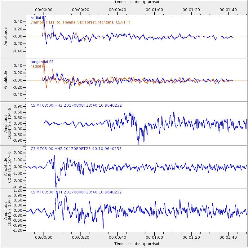
Signal To Noise
| Channel | StoN | STA | LTA |
| GS:MT03:00:HHZ:20170808T23:40:10.964023Z | 8.3312435 | 6.100424E-7 | 7.322345E-8 |
| GS:MT03:00:HH1:20170808T23:40:10.964023Z | 2.389116 | 1.9670203E-7 | 8.2332555E-8 |
| GS:MT03:00:HH2:20170808T23:40:10.964023Z | 1.3173394 | 9.117851E-8 | 6.921413E-8 |
| Arrivals |
| Ps | 4.9 SECOND |
| PpPs | 16 SECOND |
| PsPs/PpSs | 21 SECOND |


