You are here: Home > Network List > IU - Global Seismograph Network (GSN - IRIS/USGS) Stations List
> Station FURI Mt. Furi, Ethiopia > Earthquake Result Viewer
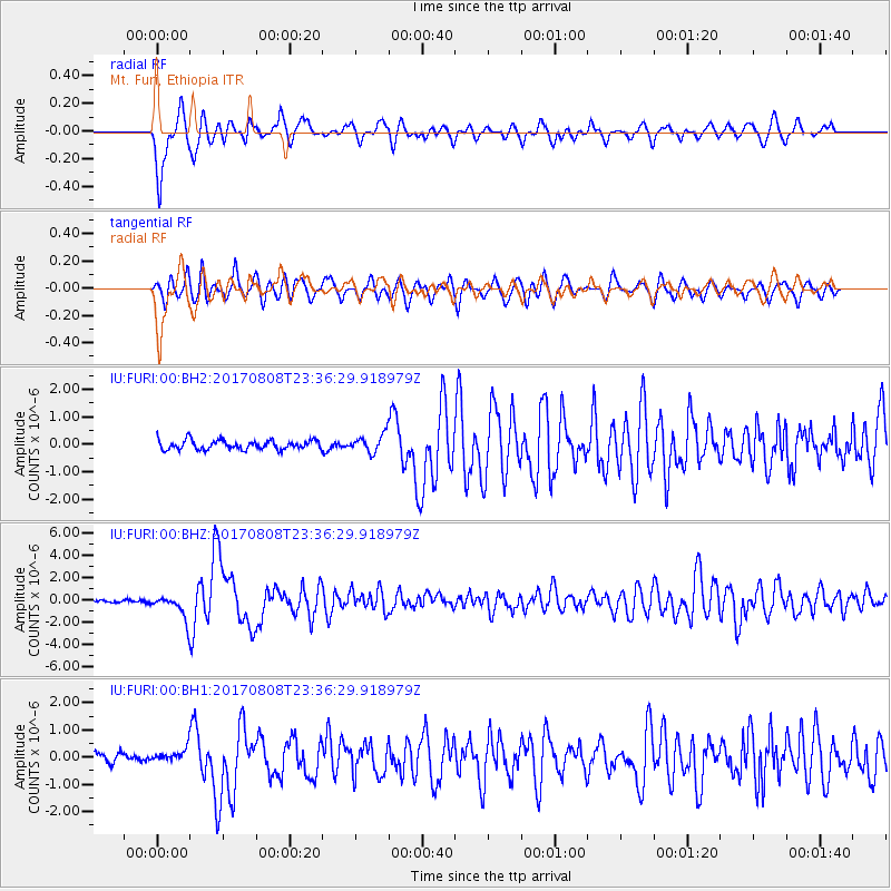
FURI Mt. Furi, Ethiopia - Earthquake Result Viewer
*The percent match for this event was below the threshold and hence no stack was calculated.
| Earthquake location: |
Northern Xinjiang, China |
| Earthquake latitude/longitude: |
44.3/82.8 |
| Earthquake time(UTC): |
2017/08/08 (220) 23:27:53 GMT |
| Earthquake Depth: |
20 km |
| Earthquake Magnitude: |
6.3 Mww |
| Earthquake Catalog/Contributor: |
NEIC PDE/us |
|
| Network: |
IU Global Seismograph Network (GSN - IRIS/USGS) |
| Station: |
FURI Mt. Furi, Ethiopia |
| Lat/Lon: |
8.90 N/38.68 E |
| Elevation: |
2570 m |
|
| Distance: |
52.0 deg |
| Az: |
240.897 deg |
| Baz: |
39.409 deg |
| Ray Param: |
$rayparam |
*The percent match for this event was below the threshold and hence was not used in the summary stack. |
|
| Radial Match: |
81.46593 % |
| Radial Bump: |
400 |
| Transverse Match: |
74.959435 % |
| Transverse Bump: |
400 |
| SOD ConfigId: |
2140511 |
| Insert Time: |
2017-08-22 15:21:06.478 +0000 |
| GWidth: |
2.5 |
| Max Bumps: |
400 |
| Tol: |
0.001 |
|
Signal To Noise
| Channel | StoN | STA | LTA |
| IU:FURI:00:BHZ:20170808T23:36:29.918979Z | 8.209593 | 1.1008966E-6 | 1.3409881E-7 |
| IU:FURI:00:BH1:20170808T23:36:29.918979Z | 1.1893936 | 2.5585078E-7 | 2.1511025E-7 |
| IU:FURI:00:BH2:20170808T23:36:29.918979Z | 1.8858857 | 3.2207888E-7 | 1.7078388E-7 |
| Arrivals |
| Ps | |
| PpPs | |
| PsPs/PpSs | |


