You are here: Home > Network List > UW - Pacific Northwest Regional Seismic Network Stations List
> Station IRON Crane, OR, USA > Earthquake Result Viewer
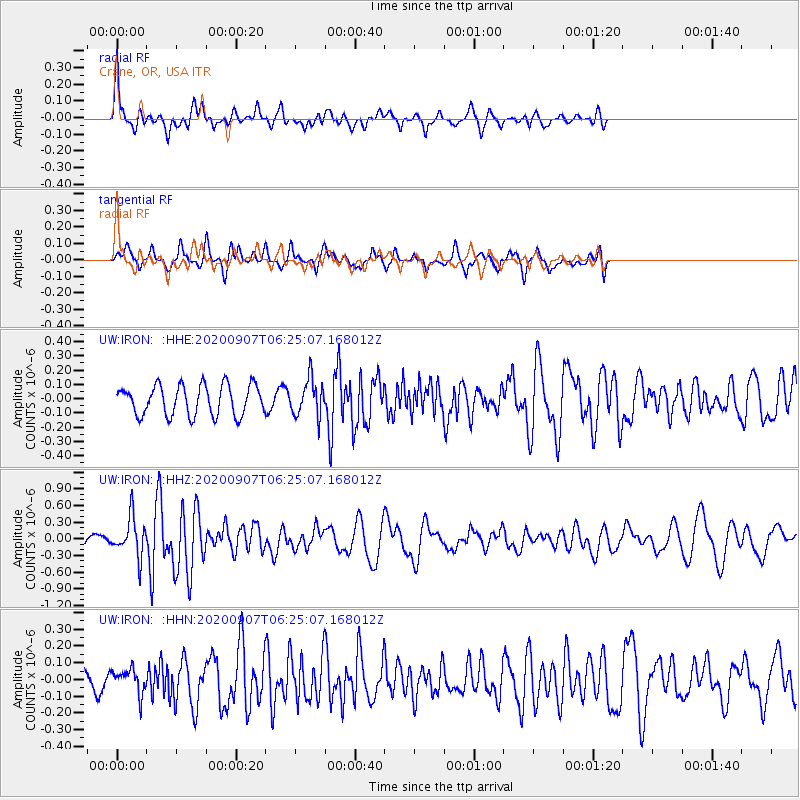
IRON Crane, OR, USA - Earthquake Result Viewer
*The percent match for this event was below the threshold and hence no stack was calculated.
| Earthquake location: |
Vanuatu Islands |
| Earthquake latitude/longitude: |
-17.1/168.5 |
| Earthquake time(UTC): |
2020/09/07 (251) 06:12:40 GMT |
| Earthquake Depth: |
10 km |
| Earthquake Magnitude: |
6.0 Mww |
| Earthquake Catalog/Contributor: |
NEIC PDE/us |
|
| Network: |
UW Pacific Northwest Regional Seismic Network |
| Station: |
IRON Crane, OR, USA |
| Lat/Lon: |
43.36 N/118.47 W |
| Elevation: |
1226 m |
|
| Distance: |
89.8 deg |
| Az: |
44.242 deg |
| Baz: |
246.185 deg |
| Ray Param: |
$rayparam |
*The percent match for this event was below the threshold and hence was not used in the summary stack. |
|
| Radial Match: |
78.9388 % |
| Radial Bump: |
400 |
| Transverse Match: |
63.85058 % |
| Transverse Bump: |
400 |
| SOD ConfigId: |
22732711 |
| Insert Time: |
2020-09-21 06:28:12.377 +0000 |
| GWidth: |
2.5 |
| Max Bumps: |
400 |
| Tol: |
0.001 |
|
Signal To Noise
| Channel | StoN | STA | LTA |
| UW:IRON: :HHZ:20200907T06:25:07.168012Z | 4.3993354 | 3.5050596E-7 | 7.9672475E-8 |
| UW:IRON: :HHN:20200907T06:25:07.168012Z | 0.91390646 | 7.138154E-8 | 7.810596E-8 |
| UW:IRON: :HHE:20200907T06:25:07.168012Z | 1.2219989 | 1.2885171E-7 | 1.0544339E-7 |
| Arrivals |
| Ps | |
| PpPs | |
| PsPs/PpSs | |


