You are here: Home > Network List > AV - Alaska Volcano Observatory Stations List
> Station PLBL Mt. Peulik Volcano, Alaska > Earthquake Result Viewer
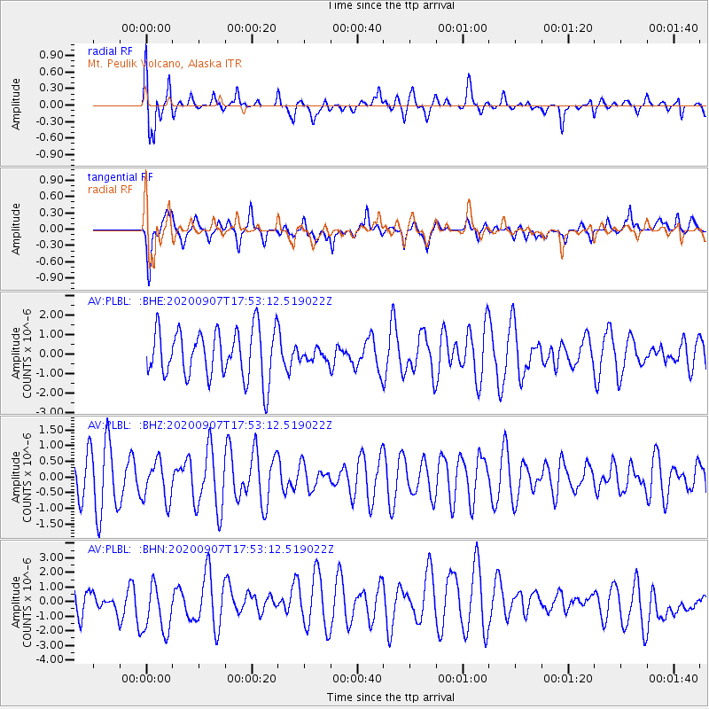
PLBL Mt. Peulik Volcano, Alaska - Earthquake Result Viewer
*The percent match for this event was below the threshold and hence no stack was calculated.
| Earthquake location: |
Easter Island Region |
| Earthquake latitude/longitude: |
-24.5/-112.0 |
| Earthquake time(UTC): |
2020/09/07 (251) 17:40:44 GMT |
| Earthquake Depth: |
10 km |
| Earthquake Magnitude: |
5.6 Mww |
| Earthquake Catalog/Contributor: |
NEIC PDE/us |
|
| Network: |
AV Alaska Volcano Observatory |
| Station: |
PLBL Mt. Peulik Volcano, Alaska |
| Lat/Lon: |
57.70 N/156.82 W |
| Elevation: |
461 m |
|
| Distance: |
90.1 deg |
| Az: |
337.756 deg |
| Baz: |
140.043 deg |
| Ray Param: |
$rayparam |
*The percent match for this event was below the threshold and hence was not used in the summary stack. |
|
| Radial Match: |
71.01987 % |
| Radial Bump: |
400 |
| Transverse Match: |
59.571365 % |
| Transverse Bump: |
400 |
| SOD ConfigId: |
22732711 |
| Insert Time: |
2020-09-21 17:43:50.917 +0000 |
| GWidth: |
2.5 |
| Max Bumps: |
400 |
| Tol: |
0.001 |
|
Signal To Noise
| Channel | StoN | STA | LTA |
| AV:PLBL: :BHZ:20200907T17:53:12.519022Z | 0.76243687 | 6.333118E-7 | 8.306416E-7 |
| AV:PLBL: :BHN:20200907T17:53:12.519022Z | 1.6265602 | 1.8118785E-6 | 1.1139326E-6 |
| AV:PLBL: :BHE:20200907T17:53:12.519022Z | 0.2722991 | 3.400091E-7 | 1.2486604E-6 |
| Arrivals |
| Ps | |
| PpPs | |
| PsPs/PpSs | |


