You are here: Home > Network List > US - United States National Seismic Network Stations List
> Station AGMN Agassiz National Wildlife Refuge, Minnesota, USA > Earthquake Result Viewer
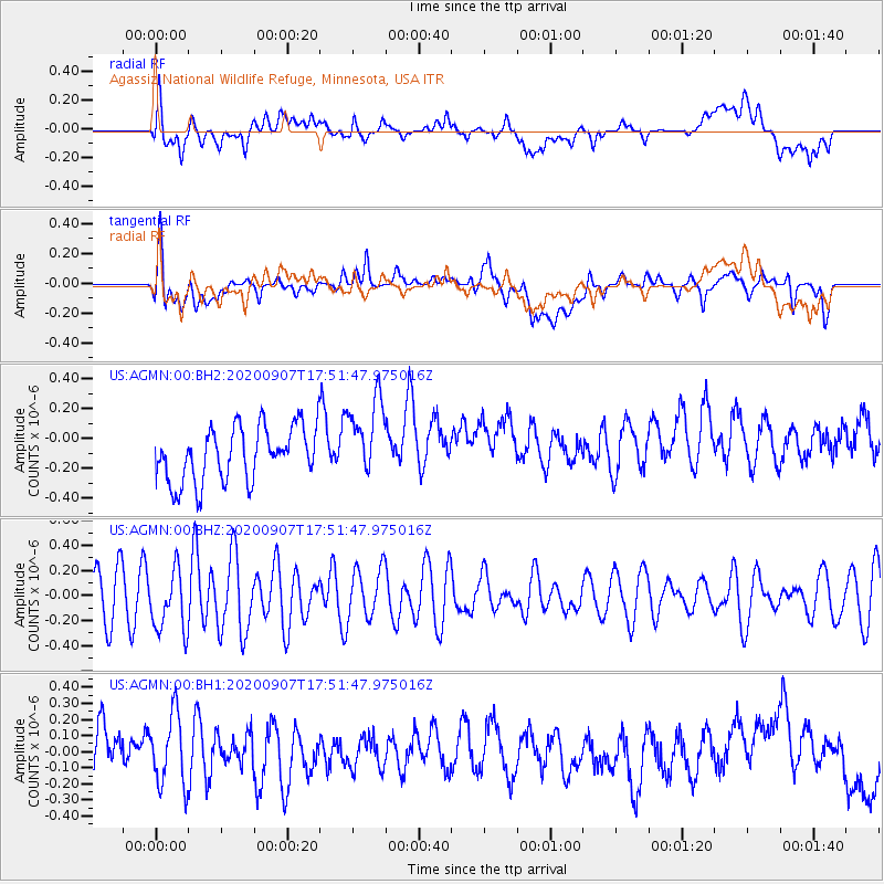
AGMN Agassiz National Wildlife Refuge, Minnesota, USA - Earthquake Result Viewer
*The percent match for this event was below the threshold and hence no stack was calculated.
| Earthquake location: |
Easter Island Region |
| Earthquake latitude/longitude: |
-24.5/-112.0 |
| Earthquake time(UTC): |
2020/09/07 (251) 17:40:44 GMT |
| Earthquake Depth: |
10 km |
| Earthquake Magnitude: |
5.6 Mww |
| Earthquake Catalog/Contributor: |
NEIC PDE/us |
|
| Network: |
US United States National Seismic Network |
| Station: |
AGMN Agassiz National Wildlife Refuge, Minnesota, USA |
| Lat/Lon: |
48.30 N/95.86 W |
| Elevation: |
351 m |
|
| Distance: |
73.9 deg |
| Az: |
11.131 deg |
| Baz: |
195.269 deg |
| Ray Param: |
$rayparam |
*The percent match for this event was below the threshold and hence was not used in the summary stack. |
|
| Radial Match: |
46.995476 % |
| Radial Bump: |
400 |
| Transverse Match: |
50.314644 % |
| Transverse Bump: |
400 |
| SOD ConfigId: |
22732711 |
| Insert Time: |
2020-09-21 17:58:27.377 +0000 |
| GWidth: |
2.5 |
| Max Bumps: |
400 |
| Tol: |
0.001 |
|
Signal To Noise
| Channel | StoN | STA | LTA |
| US:AGMN:00:BHZ:20200907T17:51:47.975016Z | 1.3341998 | 2.465333E-7 | 1.8477989E-7 |
| US:AGMN:00:BH1:20200907T17:51:47.975016Z | 1.6634333 | 2.2264801E-7 | 1.3384847E-7 |
| US:AGMN:00:BH2:20200907T17:51:47.975016Z | 1.4918619 | 2.720528E-7 | 1.823579E-7 |
| Arrivals |
| Ps | |
| PpPs | |
| PsPs/PpSs | |


