You are here: Home > Network List > CN - Canadian National Seismograph Network Stations List
> Station INK INUVIK, NT > Earthquake Result Viewer
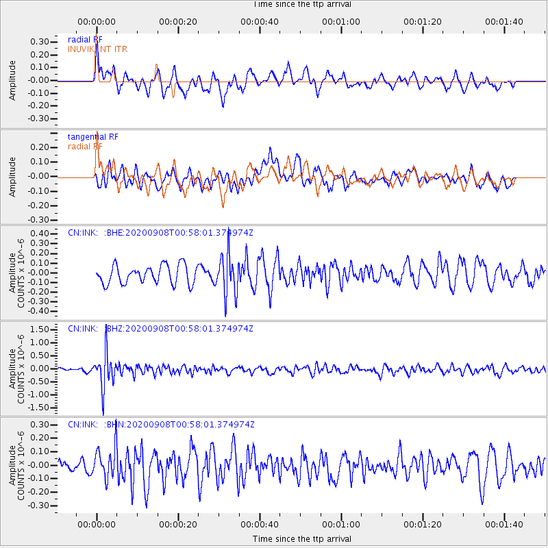
INK INUVIK, NT - Earthquake Result Viewer
*The percent match for this event was below the threshold and hence no stack was calculated.
| Earthquake location: |
Banda Sea |
| Earthquake latitude/longitude: |
-4.9/129.8 |
| Earthquake time(UTC): |
2020/09/08 (252) 00:45:20 GMT |
| Earthquake Depth: |
174 km |
| Earthquake Magnitude: |
5.9 mww |
| Earthquake Catalog/Contributor: |
NEIC PDE/us |
|
| Network: |
CN Canadian National Seismograph Network |
| Station: |
INK INUVIK, NT |
| Lat/Lon: |
68.31 N/133.53 W |
| Elevation: |
44 m |
|
| Distance: |
97.0 deg |
| Az: |
21.841 deg |
| Baz: |
274.419 deg |
| Ray Param: |
$rayparam |
*The percent match for this event was below the threshold and hence was not used in the summary stack. |
|
| Radial Match: |
59.76835 % |
| Radial Bump: |
360 |
| Transverse Match: |
40.77559 % |
| Transverse Bump: |
400 |
| SOD ConfigId: |
22732711 |
| Insert Time: |
2020-09-22 00:51:44.772 +0000 |
| GWidth: |
2.5 |
| Max Bumps: |
400 |
| Tol: |
0.001 |
|
Signal To Noise
| Channel | StoN | STA | LTA |
| CN:INK: :BHZ:20200908T00:58:01.374974Z | 6.338953 | 6.600681E-7 | 1.0412888E-7 |
| CN:INK: :BHN:20200908T00:58:01.374974Z | 1.9084696 | 1.1585091E-7 | 6.070356E-8 |
| CN:INK: :BHE:20200908T00:58:01.374974Z | 2.1966646 | 2.076463E-7 | 9.452799E-8 |
| Arrivals |
| Ps | |
| PpPs | |
| PsPs/PpSs | |


