You are here: Home > Network List > TA - USArray Transportable Network (new EarthScope stations) Stations List
> Station H31M Peel River, Yukon, CAN > Earthquake Result Viewer
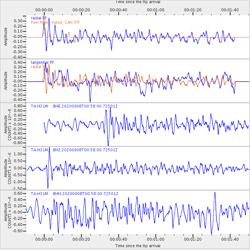
H31M Peel River, Yukon, CAN - Earthquake Result Viewer
*The percent match for this event was below the threshold and hence no stack was calculated.
| Earthquake location: |
Banda Sea |
| Earthquake latitude/longitude: |
-4.9/129.8 |
| Earthquake time(UTC): |
2020/09/08 (252) 00:45:20 GMT |
| Earthquake Depth: |
174 km |
| Earthquake Magnitude: |
5.9 mww |
| Earthquake Catalog/Contributor: |
NEIC PDE/us |
|
| Network: |
TA USArray Transportable Network (new EarthScope stations) |
| Station: |
H31M Peel River, Yukon, CAN |
| Lat/Lon: |
65.81 N/134.34 W |
| Elevation: |
642 m |
|
| Distance: |
96.9 deg |
| Az: |
24.389 deg |
| Baz: |
273.359 deg |
| Ray Param: |
$rayparam |
*The percent match for this event was below the threshold and hence was not used in the summary stack. |
|
| Radial Match: |
66.28934 % |
| Radial Bump: |
400 |
| Transverse Match: |
45.07308 % |
| Transverse Bump: |
400 |
| SOD ConfigId: |
22732711 |
| Insert Time: |
2020-09-22 00:56:50.268 +0000 |
| GWidth: |
2.5 |
| Max Bumps: |
400 |
| Tol: |
0.001 |
|
Signal To Noise
| Channel | StoN | STA | LTA |
| TA:H31M: :BHZ:20200908T00:58:00.72501Z | 4.733242 | 6.2160177E-7 | 1.3132686E-7 |
| TA:H31M: :BHN:20200908T00:58:00.72501Z | 0.77747035 | 1.8353158E-7 | 2.3606248E-7 |
| TA:H31M: :BHE:20200908T00:58:00.72501Z | 2.7728548 | 3.82444E-7 | 1.3792429E-7 |
| Arrivals |
| Ps | |
| PpPs | |
| PsPs/PpSs | |


