You are here: Home > Network List > TA - USArray Transportable Network (new EarthScope stations) Stations List
> Station I17K Unalakleet, AK, USA > Earthquake Result Viewer
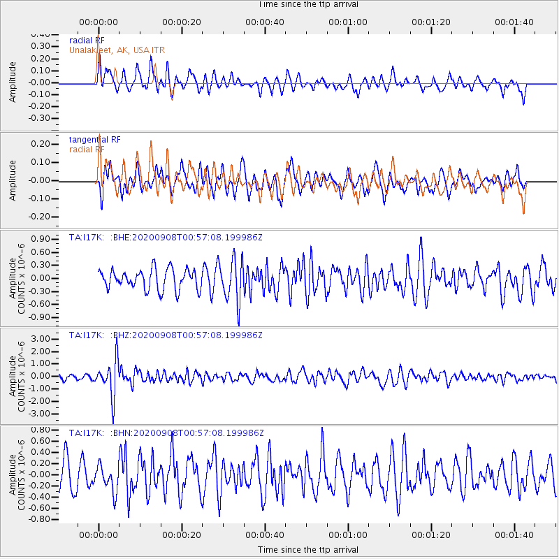
I17K Unalakleet, AK, USA - Earthquake Result Viewer
*The percent match for this event was below the threshold and hence no stack was calculated.
| Earthquake location: |
Banda Sea |
| Earthquake latitude/longitude: |
-4.9/129.8 |
| Earthquake time(UTC): |
2020/09/08 (252) 00:45:20 GMT |
| Earthquake Depth: |
174 km |
| Earthquake Magnitude: |
5.9 mww |
| Earthquake Catalog/Contributor: |
NEIC PDE/us |
|
| Network: |
TA USArray Transportable Network (new EarthScope stations) |
| Station: |
I17K Unalakleet, AK, USA |
| Lat/Lon: |
63.89 N/160.70 W |
| Elevation: |
105 m |
|
| Distance: |
85.5 deg |
| Az: |
24.575 deg |
| Baz: |
249.451 deg |
| Ray Param: |
$rayparam |
*The percent match for this event was below the threshold and hence was not used in the summary stack. |
|
| Radial Match: |
60.1612 % |
| Radial Bump: |
400 |
| Transverse Match: |
58.098145 % |
| Transverse Bump: |
400 |
| SOD ConfigId: |
22732711 |
| Insert Time: |
2020-09-22 00:56:51.610 +0000 |
| GWidth: |
2.5 |
| Max Bumps: |
400 |
| Tol: |
0.001 |
|
Signal To Noise
| Channel | StoN | STA | LTA |
| TA:I17K: :BHZ:20200908T00:57:08.199986Z | 4.5771456 | 1.4309458E-6 | 3.1262843E-7 |
| TA:I17K: :BHN:20200908T00:57:08.199986Z | 0.9415082 | 2.371624E-7 | 2.5189627E-7 |
| TA:I17K: :BHE:20200908T00:57:08.199986Z | 2.0847995 | 4.801725E-7 | 2.3032072E-7 |
| Arrivals |
| Ps | |
| PpPs | |
| PsPs/PpSs | |


