You are here: Home > Network List > TA - USArray Transportable Network (new EarthScope stations) Stations List
> Station I30M Mount Dempster, Yukon, CAN > Earthquake Result Viewer
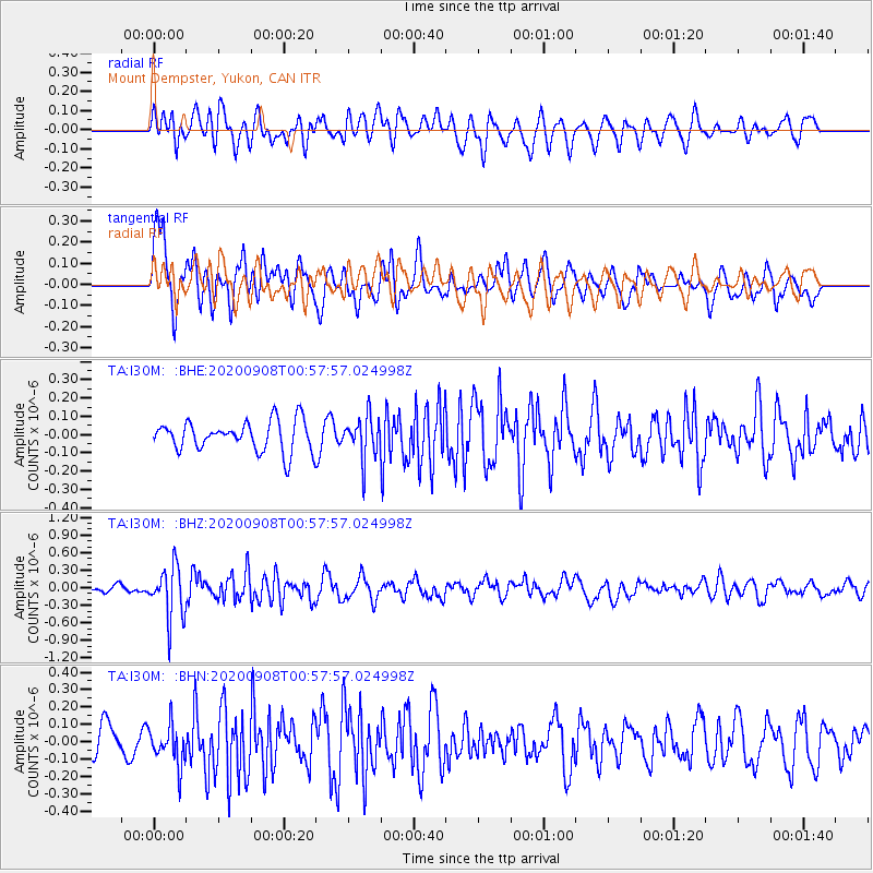
I30M Mount Dempster, Yukon, CAN - Earthquake Result Viewer
*The percent match for this event was below the threshold and hence no stack was calculated.
| Earthquake location: |
Banda Sea |
| Earthquake latitude/longitude: |
-4.9/129.8 |
| Earthquake time(UTC): |
2020/09/08 (252) 00:45:20 GMT |
| Earthquake Depth: |
174 km |
| Earthquake Magnitude: |
5.9 mww |
| Earthquake Catalog/Contributor: |
NEIC PDE/us |
|
| Network: |
TA USArray Transportable Network (new EarthScope stations) |
| Station: |
I30M Mount Dempster, Yukon, CAN |
| Lat/Lon: |
65.22 N/136.38 W |
| Elevation: |
1399 m |
|
| Distance: |
96.1 deg |
| Az: |
25.013 deg |
| Baz: |
271.44 deg |
| Ray Param: |
$rayparam |
*The percent match for this event was below the threshold and hence was not used in the summary stack. |
|
| Radial Match: |
54.550514 % |
| Radial Bump: |
400 |
| Transverse Match: |
62.92486 % |
| Transverse Bump: |
400 |
| SOD ConfigId: |
22732711 |
| Insert Time: |
2020-09-22 00:56:56.820 +0000 |
| GWidth: |
2.5 |
| Max Bumps: |
400 |
| Tol: |
0.001 |
|
Signal To Noise
| Channel | StoN | STA | LTA |
| TA:I30M: :BHZ:20200908T00:57:57.024998Z | 5.794476 | 4.4697268E-7 | 7.713772E-8 |
| TA:I30M: :BHN:20200908T00:57:57.024998Z | 1.1735392 | 1.1558117E-7 | 9.848941E-8 |
| TA:I30M: :BHE:20200908T00:57:57.024998Z | 1.3546607 | 1.1100573E-7 | 8.194356E-8 |
| Arrivals |
| Ps | |
| PpPs | |
| PsPs/PpSs | |


