You are here: Home > Network List > TA - USArray Transportable Network (new EarthScope stations) Stations List
> Station L15K Ungalak Mountain, AK, USA > Earthquake Result Viewer
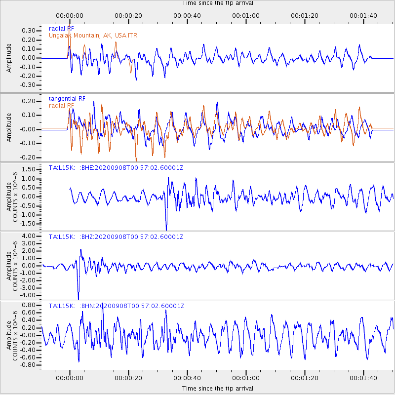
L15K Ungalak Mountain, AK, USA - Earthquake Result Viewer
*The percent match for this event was below the threshold and hence no stack was calculated.
| Earthquake location: |
Banda Sea |
| Earthquake latitude/longitude: |
-4.9/129.8 |
| Earthquake time(UTC): |
2020/09/08 (252) 00:45:20 GMT |
| Earthquake Depth: |
174 km |
| Earthquake Magnitude: |
5.9 mww |
| Earthquake Catalog/Contributor: |
NEIC PDE/us |
|
| Network: |
TA USArray Transportable Network (new EarthScope stations) |
| Station: |
L15K Ungalak Mountain, AK, USA |
| Lat/Lon: |
61.68 N/161.49 W |
| Elevation: |
219 m |
|
| Distance: |
84.4 deg |
| Az: |
26.526 deg |
| Baz: |
248.919 deg |
| Ray Param: |
$rayparam |
*The percent match for this event was below the threshold and hence was not used in the summary stack. |
|
| Radial Match: |
53.260387 % |
| Radial Bump: |
393 |
| Transverse Match: |
55.099903 % |
| Transverse Bump: |
400 |
| SOD ConfigId: |
22732711 |
| Insert Time: |
2020-09-22 00:57:11.513 +0000 |
| GWidth: |
2.5 |
| Max Bumps: |
400 |
| Tol: |
0.001 |
|
Signal To Noise
| Channel | StoN | STA | LTA |
| TA:L15K: :BHZ:20200908T00:57:02.60001Z | 5.942377 | 1.432366E-6 | 2.4104259E-7 |
| TA:L15K: :BHN:20200908T00:57:02.60001Z | 1.4033976 | 3.3813743E-7 | 2.4094203E-7 |
| TA:L15K: :BHE:20200908T00:57:02.60001Z | 2.6253088 | 5.8241744E-7 | 2.2184722E-7 |
| Arrivals |
| Ps | |
| PpPs | |
| PsPs/PpSs | |


