You are here: Home > Network List > TA - USArray Transportable Network (new EarthScope stations) Stations List
> Station G21K Allakaket, AK, USA > Earthquake Result Viewer
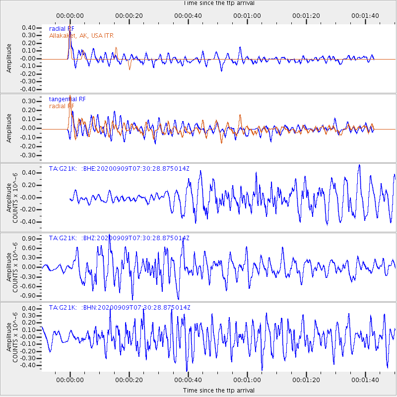
G21K Allakaket, AK, USA - Earthquake Result Viewer
*The percent match for this event was below the threshold and hence no stack was calculated.
| Earthquake location: |
Talaud Islands, Indonesia |
| Earthquake latitude/longitude: |
4.2/126.6 |
| Earthquake time(UTC): |
2020/09/09 (253) 07:18:40 GMT |
| Earthquake Depth: |
18 km |
| Earthquake Magnitude: |
5.8 mww |
| Earthquake Catalog/Contributor: |
NEIC PDE/us |
|
| Network: |
TA USArray Transportable Network (new EarthScope stations) |
| Station: |
G21K Allakaket, AK, USA |
| Lat/Lon: |
66.52 N/153.51 W |
| Elevation: |
446 m |
|
| Distance: |
82.1 deg |
| Az: |
23.469 deg |
| Baz: |
262.357 deg |
| Ray Param: |
$rayparam |
*The percent match for this event was below the threshold and hence was not used in the summary stack. |
|
| Radial Match: |
86.018585 % |
| Radial Bump: |
400 |
| Transverse Match: |
78.020004 % |
| Transverse Bump: |
400 |
| SOD ConfigId: |
22732711 |
| Insert Time: |
2020-09-23 07:28:02.432 +0000 |
| GWidth: |
2.5 |
| Max Bumps: |
400 |
| Tol: |
0.001 |
|
Signal To Noise
| Channel | StoN | STA | LTA |
| TA:G21K: :BHZ:20200909T07:30:28.875014Z | 5.570484 | 3.237672E-7 | 5.8121913E-8 |
| TA:G21K: :BHN:20200909T07:30:28.875014Z | 0.5915819 | 4.77236E-8 | 8.0671164E-8 |
| TA:G21K: :BHE:20200909T07:30:28.875014Z | 2.16364 | 1.0454507E-7 | 4.831907E-8 |
| Arrivals |
| Ps | |
| PpPs | |
| PsPs/PpSs | |


