You are here: Home > Network List > US - United States National Seismic Network Stations List
> Station AMTX Amarillo, Texas, USA > Earthquake Result Viewer
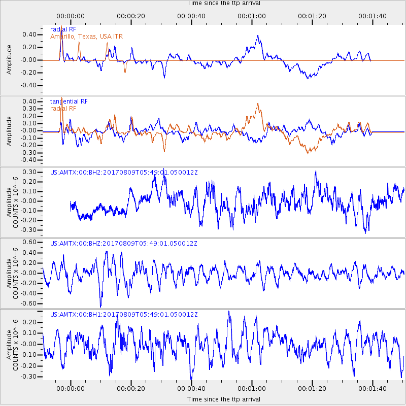
AMTX Amarillo, Texas, USA - Earthquake Result Viewer
*The percent match for this event was below the threshold and hence no stack was calculated.
| Earthquake location: |
Fox Islands, Aleutian Islands |
| Earthquake latitude/longitude: |
52.6/-169.2 |
| Earthquake time(UTC): |
2017/08/09 (221) 05:40:42 GMT |
| Earthquake Depth: |
47 km |
| Earthquake Magnitude: |
5.3 mb |
| Earthquake Catalog/Contributor: |
NEIC PDE/us |
|
| Network: |
US United States National Seismic Network |
| Station: |
AMTX Amarillo, Texas, USA |
| Lat/Lon: |
34.53 N/101.41 W |
| Elevation: |
1010 m |
|
| Distance: |
50.4 deg |
| Az: |
82.758 deg |
| Baz: |
312.824 deg |
| Ray Param: |
$rayparam |
*The percent match for this event was below the threshold and hence was not used in the summary stack. |
|
| Radial Match: |
56.7366 % |
| Radial Bump: |
400 |
| Transverse Match: |
61.13575 % |
| Transverse Bump: |
400 |
| SOD ConfigId: |
2140511 |
| Insert Time: |
2017-08-22 21:42:24.542 +0000 |
| GWidth: |
2.5 |
| Max Bumps: |
400 |
| Tol: |
0.001 |
|
Signal To Noise
| Channel | StoN | STA | LTA |
| US:AMTX:00:BHZ:20170809T05:49:01.050012Z | 1.6521201 | 1.7894587E-7 | 1.0831287E-7 |
| US:AMTX:00:BH1:20170809T05:49:01.050012Z | 0.74916965 | 6.815716E-8 | 9.097694E-8 |
| US:AMTX:00:BH2:20170809T05:49:01.050012Z | 1.0561199 | 1.00282506E-7 | 9.4953705E-8 |
| Arrivals |
| Ps | |
| PpPs | |
| PsPs/PpSs | |


