You are here: Home > Network List > US - United States National Seismic Network Stations List
> Station CBKS Cedar Bluff, Kansas, USA > Earthquake Result Viewer
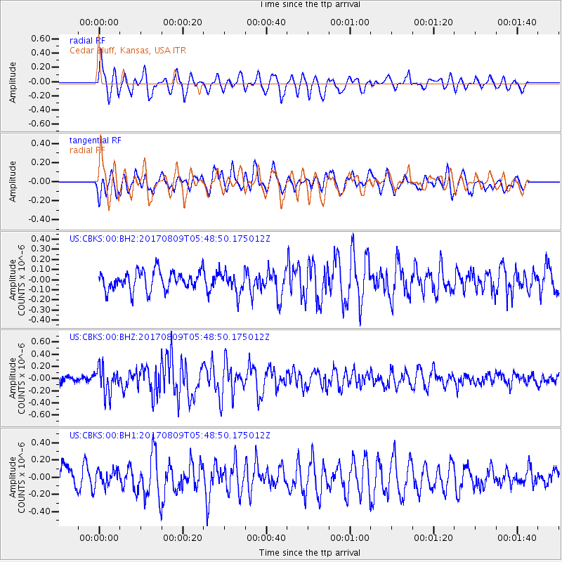
CBKS Cedar Bluff, Kansas, USA - Earthquake Result Viewer
*The percent match for this event was below the threshold and hence no stack was calculated.
| Earthquake location: |
Fox Islands, Aleutian Islands |
| Earthquake latitude/longitude: |
52.6/-169.2 |
| Earthquake time(UTC): |
2017/08/09 (221) 05:40:42 GMT |
| Earthquake Depth: |
47 km |
| Earthquake Magnitude: |
5.3 mb |
| Earthquake Catalog/Contributor: |
NEIC PDE/us |
|
| Network: |
US United States National Seismic Network |
| Station: |
CBKS Cedar Bluff, Kansas, USA |
| Lat/Lon: |
38.81 N/99.74 W |
| Elevation: |
677 m |
|
| Distance: |
48.6 deg |
| Az: |
77.376 deg |
| Baz: |
310.32 deg |
| Ray Param: |
$rayparam |
*The percent match for this event was below the threshold and hence was not used in the summary stack. |
|
| Radial Match: |
58.72931 % |
| Radial Bump: |
400 |
| Transverse Match: |
53.229145 % |
| Transverse Bump: |
400 |
| SOD ConfigId: |
2140511 |
| Insert Time: |
2017-08-22 21:42:32.964 +0000 |
| GWidth: |
2.5 |
| Max Bumps: |
400 |
| Tol: |
0.001 |
|
Signal To Noise
| Channel | StoN | STA | LTA |
| US:CBKS:00:BHZ:20170809T05:48:50.175012Z | 3.1263654 | 2.1403598E-7 | 6.84616E-8 |
| US:CBKS:00:BH1:20170809T05:48:50.175012Z | 0.8046549 | 8.585513E-8 | 1.06698074E-7 |
| US:CBKS:00:BH2:20170809T05:48:50.175012Z | 1.0933831 | 1.04028416E-7 | 9.514361E-8 |
| Arrivals |
| Ps | |
| PpPs | |
| PsPs/PpSs | |


