CLAA Clarks Junction - Earthquake Result Viewer
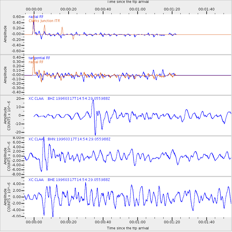
Earthquake location: Vanuatu Islands
Earthquake latitude/longitude: -14.7/167.3
Earthquake time(UTC): 1996/03/17 (077) 14:48:56 GMT
Earthquake Depth: 164 km
Earthquake Magnitude: 5.8 MB, 6.0 MS, 6.7 UNKNOWN, 6.1 MS
Earthquake Catalog/Contributor: WHDF/NEIC
Network: XC Southern Alps Passive Seismic Experiment
Station: CLAA Clarks Junction
Lat/Lon: 45.79 S/170.04 E
Elevation: 432 m
Distance: 31.1 deg
Az: 176.275 deg
Baz: 354.845 deg
Ray Param: 0.07875403
Estimated Moho Depth: 10.0 km
Estimated Crust Vp/Vs: 1.60
Assumed Crust Vp: 6.461 km/s
Estimated Crust Vs: 4.038 km/s
Estimated Crust Poisson's Ratio: 0.18
Radial Match: 82.494446 %
Radial Bump: 264
Transverse Match: 49.224087 %
Transverse Bump: 306
SOD ConfigId: 6273
Insert Time: 2010-02-26 15:06:23.841 +0000
GWidth: 2.5
Max Bumps: 400
Tol: 0.001

Signal To Noise

ChannelStoNSTALTA
XC:CLAA: :BHN:19960317T14:54:29.055988Z3.86011482.8520906E-67.388616E-7
XC:CLAA: :BHE:19960317T14:54:29.055988Z0.55891097.8123E-71.397772E-6
XC:CLAA: :BHZ:19960317T14:54:29.055988Z5.06982148.065019E-61.5907895E-6
Arrivals
Ps1.0 SECOND
PpPs3.7 SECOND
PsPs/PpSs4.7 SECOND