You are here: Home > Network List > AV - Alaska Volcano Observatory Stations List
> Station PLBL Mt. Peulik Volcano, Alaska > Earthquake Result Viewer
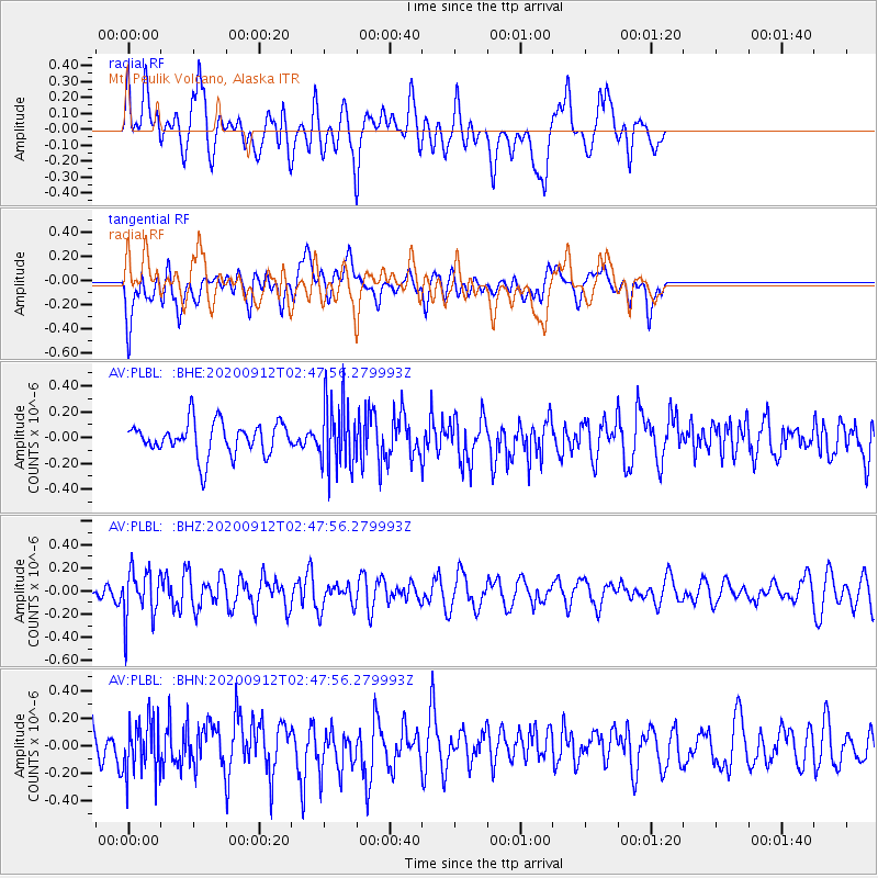
PLBL Mt. Peulik Volcano, Alaska - Earthquake Result Viewer
*The percent match for this event was below the threshold and hence no stack was calculated.
| Earthquake location: |
Fiji Islands Region |
| Earthquake latitude/longitude: |
-17.9/-178.1 |
| Earthquake time(UTC): |
2020/09/12 (256) 02:37:29 GMT |
| Earthquake Depth: |
557 km |
| Earthquake Magnitude: |
5.6 Mww |
| Earthquake Catalog/Contributor: |
NEIC PDE/us |
|
| Network: |
AV Alaska Volcano Observatory |
| Station: |
PLBL Mt. Peulik Volcano, Alaska |
| Lat/Lon: |
57.70 N/156.82 W |
| Elevation: |
461 m |
|
| Distance: |
77.3 deg |
| Az: |
11.496 deg |
| Baz: |
200.701 deg |
| Ray Param: |
$rayparam |
*The percent match for this event was below the threshold and hence was not used in the summary stack. |
|
| Radial Match: |
59.05183 % |
| Radial Bump: |
400 |
| Transverse Match: |
51.618385 % |
| Transverse Bump: |
400 |
| SOD ConfigId: |
22732711 |
| Insert Time: |
2020-09-26 02:42:48.900 +0000 |
| GWidth: |
2.5 |
| Max Bumps: |
400 |
| Tol: |
0.001 |
|
Signal To Noise
| Channel | StoN | STA | LTA |
| AV:PLBL: :BHZ:20200912T02:47:56.279993Z | 3.3422942 | 2.120683E-7 | 6.344992E-8 |
| AV:PLBL: :BHN:20200912T02:47:56.279993Z | 1.8024906 | 1.9751005E-7 | 1.09576185E-7 |
| AV:PLBL: :BHE:20200912T02:47:56.279993Z | 2.0215619 | 2.572748E-7 | 1.2726535E-7 |
| Arrivals |
| Ps | |
| PpPs | |
| PsPs/PpSs | |


