You are here: Home > Network List > CN - Canadian National Seismograph Network Stations List
> Station INK INUVIK, NT > Earthquake Result Viewer
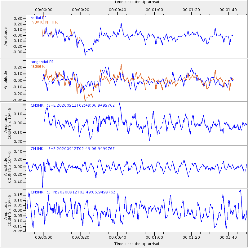
INK INUVIK, NT - Earthquake Result Viewer
*The percent match for this event was below the threshold and hence no stack was calculated.
| Earthquake location: |
Fiji Islands Region |
| Earthquake latitude/longitude: |
-17.9/-178.1 |
| Earthquake time(UTC): |
2020/09/12 (256) 02:37:29 GMT |
| Earthquake Depth: |
557 km |
| Earthquake Magnitude: |
5.6 Mww |
| Earthquake Catalog/Contributor: |
NEIC PDE/us |
|
| Network: |
CN Canadian National Seismograph Network |
| Station: |
INK INUVIK, NT |
| Lat/Lon: |
68.31 N/133.53 W |
| Elevation: |
44 m |
|
| Distance: |
91.8 deg |
| Az: |
15.121 deg |
| Baz: |
221.924 deg |
| Ray Param: |
$rayparam |
*The percent match for this event was below the threshold and hence was not used in the summary stack. |
|
| Radial Match: |
45.65535 % |
| Radial Bump: |
400 |
| Transverse Match: |
39.9362 % |
| Transverse Bump: |
400 |
| SOD ConfigId: |
22732711 |
| Insert Time: |
2020-09-26 02:46:14.921 +0000 |
| GWidth: |
2.5 |
| Max Bumps: |
400 |
| Tol: |
0.001 |
|
Signal To Noise
| Channel | StoN | STA | LTA |
| CN:INK: :BHZ:20200912T02:49:06.949976Z | 1.5347183 | 1.637242E-7 | 1.0668029E-7 |
| CN:INK: :BHN:20200912T02:49:06.949976Z | 0.8690645 | 7.093174E-8 | 8.16185E-8 |
| CN:INK: :BHE:20200912T02:49:06.949976Z | 0.8234275 | 4.916354E-8 | 5.970597E-8 |
| Arrivals |
| Ps | |
| PpPs | |
| PsPs/PpSs | |


