You are here: Home > Network List > IU - Global Seismograph Network (GSN - IRIS/USGS) Stations List
> Station JOHN Johnston Island, USA > Earthquake Result Viewer
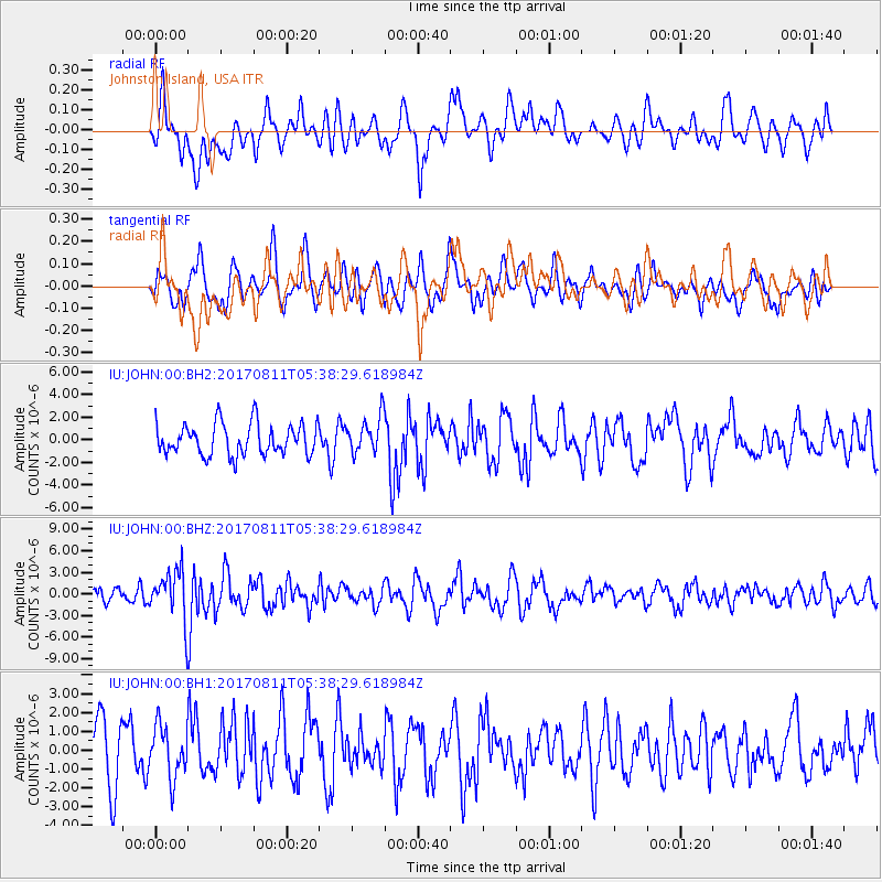
JOHN Johnston Island, USA - Earthquake Result Viewer
*The percent match for this event was below the threshold and hence no stack was calculated.
| Earthquake location: |
Luzon, Philippines |
| Earthquake latitude/longitude: |
14.0/120.7 |
| Earthquake time(UTC): |
2017/08/11 (223) 05:28:25 GMT |
| Earthquake Depth: |
168 km |
| Earthquake Magnitude: |
6.2 Mww |
| Earthquake Catalog/Contributor: |
NEIC PDE/us |
|
| Network: |
IU Global Seismograph Network (GSN - IRIS/USGS) |
| Station: |
JOHN Johnston Island, USA |
| Lat/Lon: |
16.73 N/169.53 W |
| Elevation: |
2.0 m |
|
| Distance: |
67.0 deg |
| Az: |
77.578 deg |
| Baz: |
278.393 deg |
| Ray Param: |
$rayparam |
*The percent match for this event was below the threshold and hence was not used in the summary stack. |
|
| Radial Match: |
53.90201 % |
| Radial Bump: |
400 |
| Transverse Match: |
44.73168 % |
| Transverse Bump: |
400 |
| SOD ConfigId: |
2140511 |
| Insert Time: |
2017-08-24 21:24:35.905 +0000 |
| GWidth: |
2.5 |
| Max Bumps: |
400 |
| Tol: |
0.001 |
|
Signal To Noise
| Channel | StoN | STA | LTA |
| IU:JOHN:00:BHZ:20170811T05:38:29.618984Z | 3.4065123 | 3.3961558E-6 | 9.969598E-7 |
| IU:JOHN:00:BH1:20170811T05:38:29.618984Z | 0.86824894 | 1.3616346E-6 | 1.5682537E-6 |
| IU:JOHN:00:BH2:20170811T05:38:29.618984Z | 1.1660608 | 1.6114905E-6 | 1.3819952E-6 |
| Arrivals |
| Ps | |
| PpPs | |
| PsPs/PpSs | |


