You are here: Home > Network List > IU - Global Seismograph Network (GSN - IRIS/USGS) Stations List
> Station JOHN Johnston Island, USA > Earthquake Result Viewer
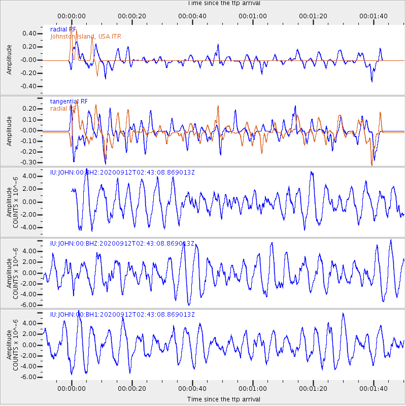
JOHN Johnston Island, USA - Earthquake Result Viewer
*The percent match for this event was below the threshold and hence no stack was calculated.
| Earthquake location: |
Fiji Islands Region |
| Earthquake latitude/longitude: |
-17.9/-178.1 |
| Earthquake time(UTC): |
2020/09/12 (256) 02:37:29 GMT |
| Earthquake Depth: |
557 km |
| Earthquake Magnitude: |
5.6 Mww |
| Earthquake Catalog/Contributor: |
NEIC PDE/us |
|
| Network: |
IU Global Seismograph Network (GSN - IRIS/USGS) |
| Station: |
JOHN Johnston Island, USA |
| Lat/Lon: |
16.73 N/169.53 W |
| Elevation: |
2.0 m |
|
| Distance: |
35.4 deg |
| Az: |
14.193 deg |
| Baz: |
194.104 deg |
| Ray Param: |
$rayparam |
*The percent match for this event was below the threshold and hence was not used in the summary stack. |
|
| Radial Match: |
45.15599 % |
| Radial Bump: |
400 |
| Transverse Match: |
49.98254 % |
| Transverse Bump: |
400 |
| SOD ConfigId: |
22732711 |
| Insert Time: |
2020-09-26 02:47:51.355 +0000 |
| GWidth: |
2.5 |
| Max Bumps: |
400 |
| Tol: |
0.001 |
|
Signal To Noise
| Channel | StoN | STA | LTA |
| IU:JOHN:00:BHZ:20200912T02:43:08.869013Z | 0.8736812 | 1.5391142E-6 | 1.7616429E-6 |
| IU:JOHN:00:BH1:20200912T02:43:08.869013Z | 2.6763506 | 3.9230445E-6 | 1.4658186E-6 |
| IU:JOHN:00:BH2:20200912T02:43:08.869013Z | 0.91341597 | 2.1556782E-6 | 2.360018E-6 |
| Arrivals |
| Ps | |
| PpPs | |
| PsPs/PpSs | |


