You are here: Home > Network List > TA - USArray Transportable Network (new EarthScope stations) Stations List
> Station G21K Allakaket, AK, USA > Earthquake Result Viewer
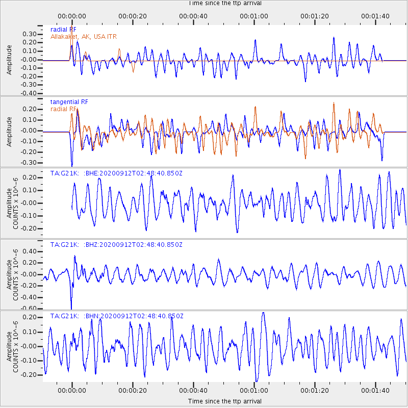
G21K Allakaket, AK, USA - Earthquake Result Viewer
*The percent match for this event was below the threshold and hence no stack was calculated.
| Earthquake location: |
Fiji Islands Region |
| Earthquake latitude/longitude: |
-17.9/-178.1 |
| Earthquake time(UTC): |
2020/09/12 (256) 02:37:29 GMT |
| Earthquake Depth: |
557 km |
| Earthquake Magnitude: |
5.6 Mww |
| Earthquake Catalog/Contributor: |
NEIC PDE/us |
|
| Network: |
TA USArray Transportable Network (new EarthScope stations) |
| Station: |
G21K Allakaket, AK, USA |
| Lat/Lon: |
66.52 N/153.51 W |
| Elevation: |
446 m |
|
| Distance: |
86.1 deg |
| Az: |
9.607 deg |
| Baz: |
203.363 deg |
| Ray Param: |
$rayparam |
*The percent match for this event was below the threshold and hence was not used in the summary stack. |
|
| Radial Match: |
55.44172 % |
| Radial Bump: |
400 |
| Transverse Match: |
53.865955 % |
| Transverse Bump: |
400 |
| SOD ConfigId: |
22732711 |
| Insert Time: |
2020-09-26 02:52:10.968 +0000 |
| GWidth: |
2.5 |
| Max Bumps: |
400 |
| Tol: |
0.001 |
|
Signal To Noise
| Channel | StoN | STA | LTA |
| TA:G21K: :BHZ:20200912T02:48:40.850Z | 1.9551454 | 1.9411485E-7 | 9.92841E-8 |
| TA:G21K: :BHN:20200912T02:48:40.850Z | 1.0244324 | 8.6130946E-8 | 8.4076746E-8 |
| TA:G21K: :BHE:20200912T02:48:40.850Z | 0.70567274 | 6.982467E-8 | 9.8947666E-8 |
| Arrivals |
| Ps | |
| PpPs | |
| PsPs/PpSs | |


