You are here: Home > Network List > TA - USArray Transportable Network (new EarthScope stations) Stations List
> Station I17K Unalakleet, AK, USA > Earthquake Result Viewer
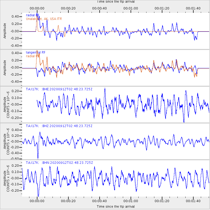
I17K Unalakleet, AK, USA - Earthquake Result Viewer
*The percent match for this event was below the threshold and hence no stack was calculated.
| Earthquake location: |
Fiji Islands Region |
| Earthquake latitude/longitude: |
-17.9/-178.1 |
| Earthquake time(UTC): |
2020/09/12 (256) 02:37:29 GMT |
| Earthquake Depth: |
557 km |
| Earthquake Magnitude: |
5.6 Mww |
| Earthquake Catalog/Contributor: |
NEIC PDE/us |
|
| Network: |
TA USArray Transportable Network (new EarthScope stations) |
| Station: |
I17K Unalakleet, AK, USA |
| Lat/Lon: |
63.89 N/160.70 W |
| Elevation: |
105 m |
|
| Distance: |
82.6 deg |
| Az: |
7.651 deg |
| Baz: |
196.649 deg |
| Ray Param: |
$rayparam |
*The percent match for this event was below the threshold and hence was not used in the summary stack. |
|
| Radial Match: |
65.3399 % |
| Radial Bump: |
400 |
| Transverse Match: |
57.476643 % |
| Transverse Bump: |
400 |
| SOD ConfigId: |
22732711 |
| Insert Time: |
2020-09-26 02:52:25.545 +0000 |
| GWidth: |
2.5 |
| Max Bumps: |
400 |
| Tol: |
0.001 |
|
Signal To Noise
| Channel | StoN | STA | LTA |
| TA:I17K: :BHZ:20200912T02:48:23.725Z | 4.0842204 | 2.169861E-7 | 5.312791E-8 |
| TA:I17K: :BHN:20200912T02:48:23.725Z | 1.5903459 | 1.3825337E-7 | 8.693289E-8 |
| TA:I17K: :BHE:20200912T02:48:23.725Z | 0.5694669 | 4.4610616E-8 | 7.833751E-8 |
| Arrivals |
| Ps | |
| PpPs | |
| PsPs/PpSs | |


