You are here: Home > Network List > GS - US Geological Survey Networks Stations List
> Station OK051 E0350 and S34600 Roads, Ralston, OK > Earthquake Result Viewer
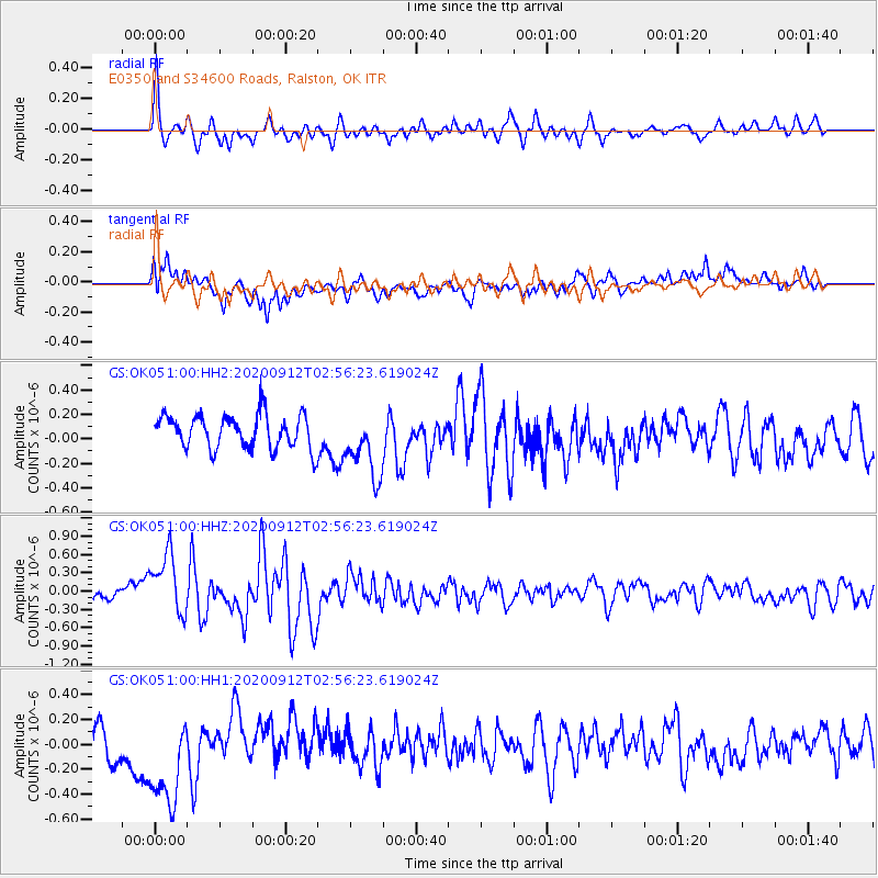
OK051 E0350 and S34600 Roads, Ralston, OK - Earthquake Result Viewer
*The percent match for this event was below the threshold and hence no stack was calculated.
| Earthquake location: |
Near East Coast Of Honshu, Japan |
| Earthquake latitude/longitude: |
38.8/142.2 |
| Earthquake time(UTC): |
2020/09/12 (256) 02:44:10 GMT |
| Earthquake Depth: |
32 km |
| Earthquake Magnitude: |
6.1 mww |
| Earthquake Catalog/Contributor: |
NEIC PDE/us |
|
| Network: |
GS US Geological Survey Networks |
| Station: |
OK051 E0350 and S34600 Roads, Ralston, OK |
| Lat/Lon: |
36.51 N/96.84 W |
| Elevation: |
263 m |
|
| Distance: |
87.4 deg |
| Az: |
43.785 deg |
| Baz: |
317.821 deg |
| Ray Param: |
$rayparam |
*The percent match for this event was below the threshold and hence was not used in the summary stack. |
|
| Radial Match: |
66.8529 % |
| Radial Bump: |
358 |
| Transverse Match: |
69.667816 % |
| Transverse Bump: |
400 |
| SOD ConfigId: |
22732711 |
| Insert Time: |
2020-09-26 03:09:43.421 +0000 |
| GWidth: |
2.5 |
| Max Bumps: |
400 |
| Tol: |
0.001 |
|
Signal To Noise
| Channel | StoN | STA | LTA |
| GS:OK051:00:HHZ:20200912T02:56:23.619024Z | 5.9182405 | 5.2473706E-7 | 8.8664365E-8 |
| GS:OK051:00:HH1:20200912T02:56:23.619024Z | 3.5911696 | 4.4785935E-7 | 1.2471128E-7 |
| GS:OK051:00:HH2:20200912T02:56:23.619024Z | 1.9875191 | 2.7202105E-7 | 1.3686461E-7 |
| Arrivals |
| Ps | |
| PpPs | |
| PsPs/PpSs | |


