You are here: Home > Network List > TA - USArray Transportable Network (new EarthScope stations) Stations List
> Station F20K Avaraart Lake, AK, USA > Earthquake Result Viewer
F20K Avaraart Lake, AK, USA - Earthquake Result Viewer

| Earthquake location: |
Near East Coast Of Honshu, Japan |
| Earthquake latitude/longitude: |
38.8/142.2 |
| Earthquake time(UTC): |
2020/09/12 (256) 02:44:10 GMT |
| Earthquake Depth: |
32 km |
| Earthquake Magnitude: |
6.1 mww |
| Earthquake Catalog/Contributor: |
NEIC PDE/us |
|
| Network: |
TA USArray Transportable Network (new EarthScope stations) |
| Station: |
F20K Avaraart Lake, AK, USA |
| Lat/Lon: |
67.05 N/155.73 W |
| Elevation: |
136 m |
|
| Distance: |
44.2 deg |
| Az: |
29.811 deg |
| Baz: |
262.344 deg |
| Ray Param: |
0.07204161 |
| Estimated Moho Depth: |
31.25 km |
| Estimated Crust Vp/Vs: |
1.60 |
| Assumed Crust Vp: |
6.522 km/s |
| Estimated Crust Vs: |
4.07 km/s |
| Estimated Crust Poisson's Ratio: |
0.18 |
|
| Radial Match: |
85.51562 % |
| Radial Bump: |
400 |
| Transverse Match: |
70.28686 % |
| Transverse Bump: |
400 |
| SOD ConfigId: |
22732711 |
| Insert Time: |
2020-09-26 03:21:28.974 +0000 |
| GWidth: |
2.5 |
| Max Bumps: |
400 |
| Tol: |
0.001 |
|
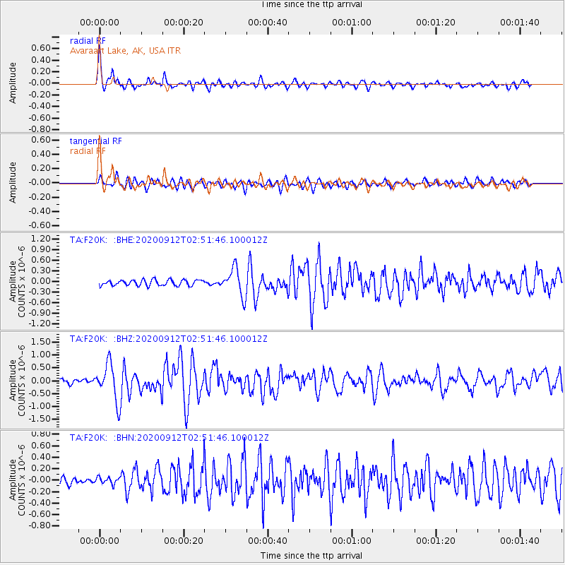
Signal To Noise
| Channel | StoN | STA | LTA |
| TA:F20K: :BHZ:20200912T02:51:46.100012Z | 10.333431 | 7.4078224E-7 | 7.168793E-8 |
| TA:F20K: :BHN:20200912T02:51:46.100012Z | 0.79607165 | 6.277247E-8 | 7.885279E-8 |
| TA:F20K: :BHE:20200912T02:51:46.100012Z | 5.031487 | 4.0269794E-7 | 8.003557E-8 |
| Arrivals |
| Ps | 3.1 SECOND |
| PpPs | 12 SECOND |
| PsPs/PpSs | 15 SECOND |


