You are here: Home > Network List > TA - USArray Transportable Network (new EarthScope stations) Stations List
> Station F21K Alatna River, AK, USA > Earthquake Result Viewer
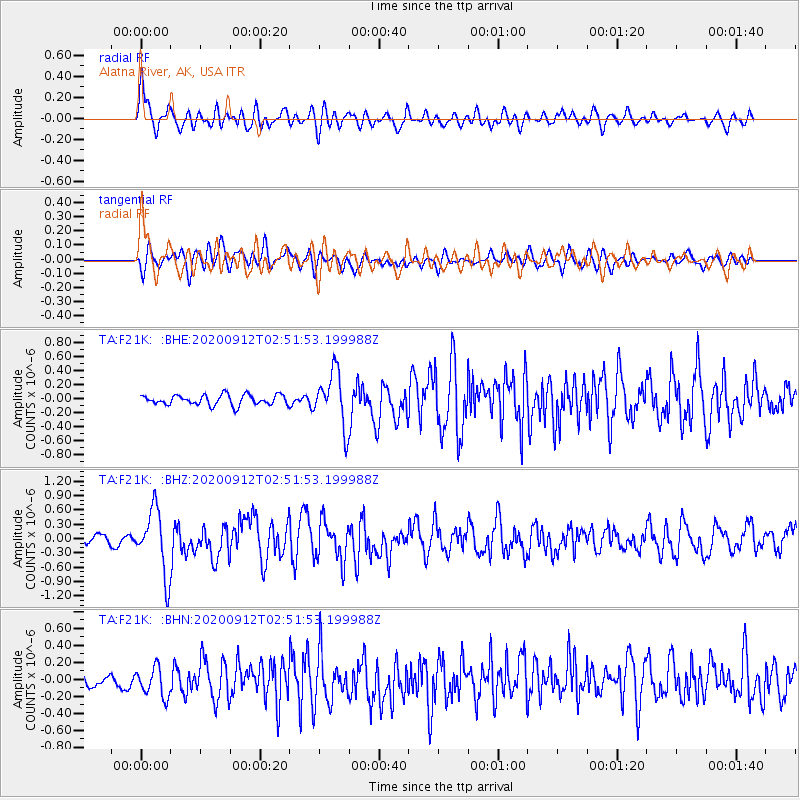
F21K Alatna River, AK, USA - Earthquake Result Viewer
*The percent match for this event was below the threshold and hence no stack was calculated.
| Earthquake location: |
Near East Coast Of Honshu, Japan |
| Earthquake latitude/longitude: |
38.8/142.2 |
| Earthquake time(UTC): |
2020/09/12 (256) 02:44:10 GMT |
| Earthquake Depth: |
32 km |
| Earthquake Magnitude: |
6.1 mww |
| Earthquake Catalog/Contributor: |
NEIC PDE/us |
|
| Network: |
TA USArray Transportable Network (new EarthScope stations) |
| Station: |
F21K Alatna River, AK, USA |
| Lat/Lon: |
67.22 N/153.48 W |
| Elevation: |
597 m |
|
| Distance: |
45.1 deg |
| Az: |
29.709 deg |
| Baz: |
264.335 deg |
| Ray Param: |
$rayparam |
*The percent match for this event was below the threshold and hence was not used in the summary stack. |
|
| Radial Match: |
73.44972 % |
| Radial Bump: |
400 |
| Transverse Match: |
49.21695 % |
| Transverse Bump: |
400 |
| SOD ConfigId: |
22732711 |
| Insert Time: |
2020-09-26 03:21:29.113 +0000 |
| GWidth: |
2.5 |
| Max Bumps: |
400 |
| Tol: |
0.001 |
|
Signal To Noise
| Channel | StoN | STA | LTA |
| TA:F21K: :BHZ:20200912T02:51:53.199988Z | 5.5359783 | 6.744866E-7 | 1.2183693E-7 |
| TA:F21K: :BHN:20200912T02:51:53.199988Z | 1.5061189 | 1.7815965E-7 | 1.18290565E-7 |
| TA:F21K: :BHE:20200912T02:51:53.199988Z | 5.280509 | 3.854785E-7 | 7.300026E-8 |
| Arrivals |
| Ps | |
| PpPs | |
| PsPs/PpSs | |


