You are here: Home > Network List > TA - USArray Transportable Network (new EarthScope stations) Stations List
> Station TUL3 Leonard, OK, USA > Earthquake Result Viewer
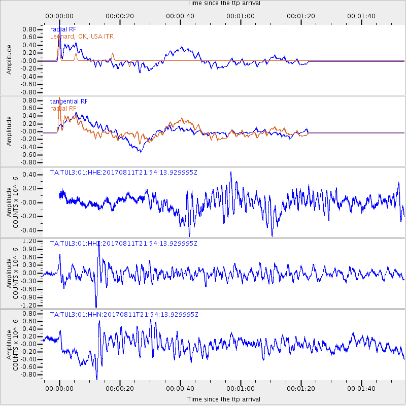
TUL3 Leonard, OK, USA - Earthquake Result Viewer
*The percent match for this event was below the threshold and hence no stack was calculated.
| Earthquake location: |
Near Coast Of Peru |
| Earthquake latitude/longitude: |
-16.3/-73.5 |
| Earthquake time(UTC): |
2017/08/11 (223) 21:45:09 GMT |
| Earthquake Depth: |
35 km |
| Earthquake Magnitude: |
5.6 Mww |
| Earthquake Catalog/Contributor: |
NEIC PDE/us |
|
| Network: |
TA USArray Transportable Network (new EarthScope stations) |
| Station: |
TUL3 Leonard, OK, USA |
| Lat/Lon: |
35.91 N/95.79 W |
| Elevation: |
265 m |
|
| Distance: |
56.1 deg |
| Az: |
338.193 deg |
| Baz: |
153.932 deg |
| Ray Param: |
$rayparam |
*The percent match for this event was below the threshold and hence was not used in the summary stack. |
|
| Radial Match: |
44.732826 % |
| Radial Bump: |
400 |
| Transverse Match: |
26.804329 % |
| Transverse Bump: |
400 |
| SOD ConfigId: |
2140511 |
| Insert Time: |
2017-08-25 13:41:10.737 +0000 |
| GWidth: |
2.5 |
| Max Bumps: |
400 |
| Tol: |
0.001 |
|
Signal To Noise
| Channel | StoN | STA | LTA |
| TA:TUL3:01:HHZ:20170811T21:54:13.929995Z | 5.1911364 | 2.9245297E-7 | 5.6336983E-8 |
| TA:TUL3:01:HHN:20170811T21:54:13.929995Z | 0.78035843 | 1.9647631E-7 | 2.51777E-7 |
| TA:TUL3:01:HHE:20170811T21:54:13.929995Z | 1.4734322 | 8.860563E-8 | 6.0135534E-8 |
| Arrivals |
| Ps | |
| PpPs | |
| PsPs/PpSs | |


