You are here: Home > Network List > TA - USArray Transportable Network (new EarthScope stations) Stations List
> Station R33M Jennings River, BC, CAN > Earthquake Result Viewer
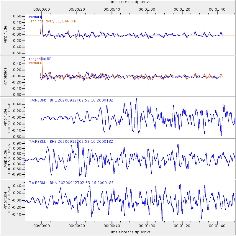
R33M Jennings River, BC, CAN - Earthquake Result Viewer
*The percent match for this event was below the threshold and hence no stack was calculated.
| Earthquake location: |
Near East Coast Of Honshu, Japan |
| Earthquake latitude/longitude: |
38.8/142.2 |
| Earthquake time(UTC): |
2020/09/12 (256) 02:44:10 GMT |
| Earthquake Depth: |
32 km |
| Earthquake Magnitude: |
6.1 mww |
| Earthquake Catalog/Contributor: |
NEIC PDE/us |
|
| Network: |
TA USArray Transportable Network (new EarthScope stations) |
| Station: |
R33M Jennings River, BC, CAN |
| Lat/Lon: |
59.39 N/130.97 W |
| Elevation: |
1437 m |
|
| Distance: |
56.1 deg |
| Az: |
38.0 deg |
| Baz: |
289.82 deg |
| Ray Param: |
$rayparam |
*The percent match for this event was below the threshold and hence was not used in the summary stack. |
|
| Radial Match: |
75.86584 % |
| Radial Bump: |
400 |
| Transverse Match: |
62.367695 % |
| Transverse Bump: |
400 |
| SOD ConfigId: |
22732711 |
| Insert Time: |
2020-09-26 03:23:14.750 +0000 |
| GWidth: |
2.5 |
| Max Bumps: |
400 |
| Tol: |
0.001 |
|
Signal To Noise
| Channel | StoN | STA | LTA |
| TA:R33M: :BHZ:20200912T02:53:16.200018Z | 5.11277 | 3.2260064E-7 | 6.309704E-8 |
| TA:R33M: :BHN:20200912T02:53:16.200018Z | 2.1859474 | 1.10305834E-7 | 5.046134E-8 |
| TA:R33M: :BHE:20200912T02:53:16.200018Z | 2.2623532 | 1.4222273E-7 | 6.2864956E-8 |
| Arrivals |
| Ps | |
| PpPs | |
| PsPs/PpSs | |


