You are here: Home > Network List > US - United States National Seismic Network Stations List
> Station MNTX Cornudas Mountains, Texas, USA > Earthquake Result Viewer
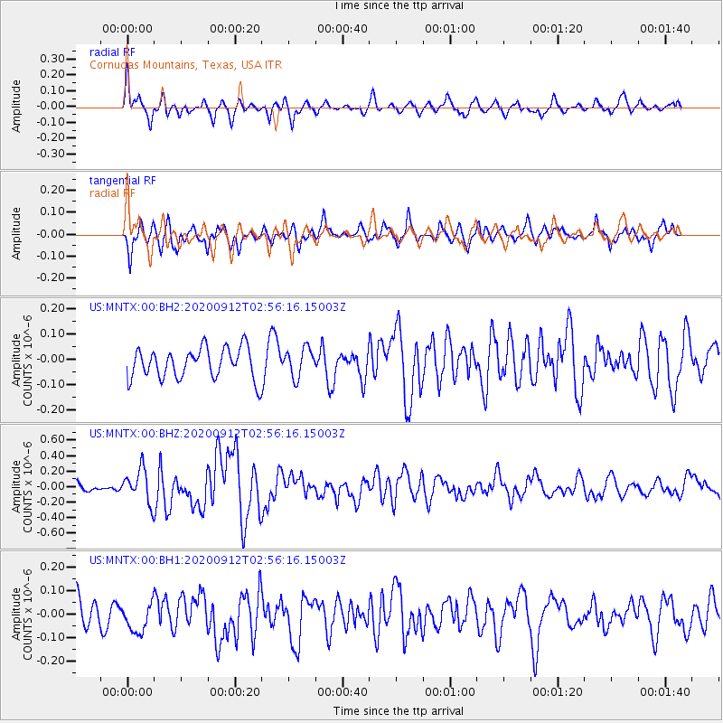
MNTX Cornudas Mountains, Texas, USA - Earthquake Result Viewer
*The percent match for this event was below the threshold and hence no stack was calculated.
| Earthquake location: |
Near East Coast Of Honshu, Japan |
| Earthquake latitude/longitude: |
38.8/142.2 |
| Earthquake time(UTC): |
2020/09/12 (256) 02:44:10 GMT |
| Earthquake Depth: |
32 km |
| Earthquake Magnitude: |
6.1 mww |
| Earthquake Catalog/Contributor: |
NEIC PDE/us |
|
| Network: |
US United States National Seismic Network |
| Station: |
MNTX Cornudas Mountains, Texas, USA |
| Lat/Lon: |
31.70 N/105.38 W |
| Elevation: |
404 m |
|
| Distance: |
85.8 deg |
| Az: |
52.215 deg |
| Baz: |
313.54 deg |
| Ray Param: |
$rayparam |
*The percent match for this event was below the threshold and hence was not used in the summary stack. |
|
| Radial Match: |
78.046844 % |
| Radial Bump: |
372 |
| Transverse Match: |
64.24375 % |
| Transverse Bump: |
400 |
| SOD ConfigId: |
22732711 |
| Insert Time: |
2020-09-26 03:26:20.363 +0000 |
| GWidth: |
2.5 |
| Max Bumps: |
400 |
| Tol: |
0.001 |
|
Signal To Noise
| Channel | StoN | STA | LTA |
| US:MNTX:00:BHZ:20200912T02:56:16.15003Z | 3.1345742 | 2.1826013E-7 | 6.962991E-8 |
| US:MNTX:00:BH1:20200912T02:56:16.15003Z | 0.9709616 | 6.202127E-8 | 6.387613E-8 |
| US:MNTX:00:BH2:20200912T02:56:16.15003Z | 0.94418 | 5.673974E-8 | 6.0094195E-8 |
| Arrivals |
| Ps | |
| PpPs | |
| PsPs/PpSs | |


