You are here: Home > Network List > US - United States National Seismic Network Stations List
> Station LAO LASA Array, Montana, USA > Earthquake Result Viewer
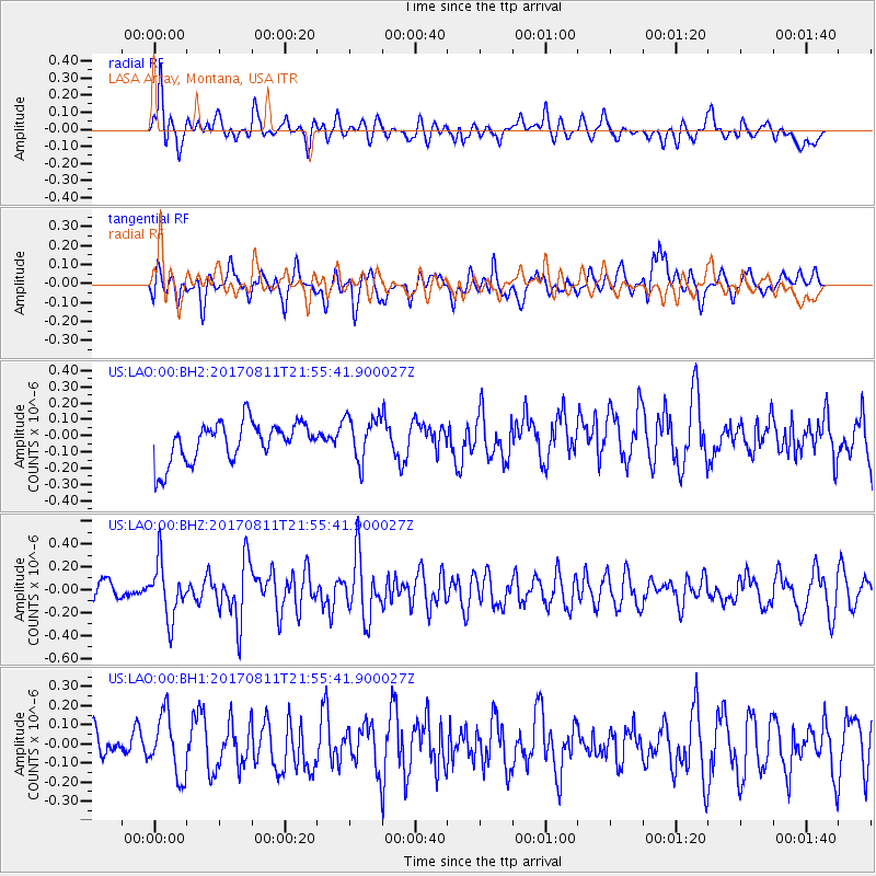
LAO LASA Array, Montana, USA - Earthquake Result Viewer
*The percent match for this event was below the threshold and hence no stack was calculated.
| Earthquake location: |
Near Coast Of Peru |
| Earthquake latitude/longitude: |
-16.3/-73.5 |
| Earthquake time(UTC): |
2017/08/11 (223) 21:45:09 GMT |
| Earthquake Depth: |
35 km |
| Earthquake Magnitude: |
5.6 Mww |
| Earthquake Catalog/Contributor: |
NEIC PDE/us |
|
| Network: |
US United States National Seismic Network |
| Station: |
LAO LASA Array, Montana, USA |
| Lat/Lon: |
46.69 N/106.22 W |
| Elevation: |
902 m |
|
| Distance: |
69.3 deg |
| Az: |
336.543 deg |
| Baz: |
146.269 deg |
| Ray Param: |
$rayparam |
*The percent match for this event was below the threshold and hence was not used in the summary stack. |
|
| Radial Match: |
38.669334 % |
| Radial Bump: |
400 |
| Transverse Match: |
40.147266 % |
| Transverse Bump: |
400 |
| SOD ConfigId: |
2140511 |
| Insert Time: |
2017-08-25 13:41:55.588 +0000 |
| GWidth: |
2.5 |
| Max Bumps: |
400 |
| Tol: |
0.001 |
|
Signal To Noise
| Channel | StoN | STA | LTA |
| US:LAO:00:BHZ:20170811T21:55:41.900027Z | 2.5339086 | 2.3795981E-7 | 9.391018E-8 |
| US:LAO:00:BH1:20170811T21:55:41.900027Z | 1.7366885 | 1.5755302E-7 | 9.072037E-8 |
| US:LAO:00:BH2:20170811T21:55:41.900027Z | 1.1487951 | 1.3824216E-7 | 1.2033667E-7 |
| Arrivals |
| Ps | |
| PpPs | |
| PsPs/PpSs | |


