You are here: Home > Network List > US - United States National Seismic Network Stations List
> Station NEW Newport, Washington, USA > Earthquake Result Viewer
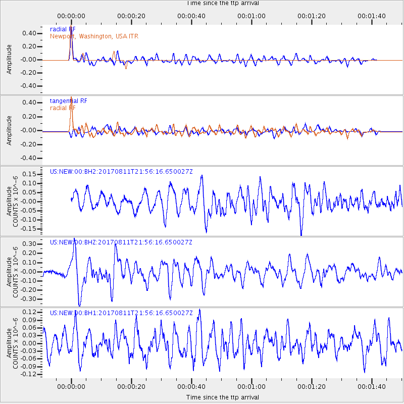
NEW Newport, Washington, USA - Earthquake Result Viewer
*The percent match for this event was below the threshold and hence no stack was calculated.
| Earthquake location: |
Near Coast Of Peru |
| Earthquake latitude/longitude: |
-16.3/-73.5 |
| Earthquake time(UTC): |
2017/08/11 (223) 21:45:09 GMT |
| Earthquake Depth: |
35 km |
| Earthquake Magnitude: |
5.6 Mww |
| Earthquake Catalog/Contributor: |
NEIC PDE/us |
|
| Network: |
US United States National Seismic Network |
| Station: |
NEW Newport, Washington, USA |
| Lat/Lon: |
48.26 N/117.12 W |
| Elevation: |
760 m |
|
| Distance: |
75.1 deg |
| Az: |
331.501 deg |
| Baz: |
136.707 deg |
| Ray Param: |
$rayparam |
*The percent match for this event was below the threshold and hence was not used in the summary stack. |
|
| Radial Match: |
70.79479 % |
| Radial Bump: |
397 |
| Transverse Match: |
55.63646 % |
| Transverse Bump: |
400 |
| SOD ConfigId: |
2140511 |
| Insert Time: |
2017-08-25 13:42:11.452 +0000 |
| GWidth: |
2.5 |
| Max Bumps: |
400 |
| Tol: |
0.001 |
|
Signal To Noise
| Channel | StoN | STA | LTA |
| US:NEW:00:BHZ:20170811T21:56:16.650027Z | 5.3193407 | 2.1334894E-7 | 4.0108155E-8 |
| US:NEW:00:BH1:20170811T21:56:16.650027Z | 2.0251994 | 5.9328038E-8 | 2.9294913E-8 |
| US:NEW:00:BH2:20170811T21:56:16.650027Z | 1.8449832 | 7.320406E-8 | 3.967736E-8 |
| Arrivals |
| Ps | |
| PpPs | |
| PsPs/PpSs | |


