You are here: Home > Network List > UW - Pacific Northwest Regional Seismic Network Stations List
> Station IRON Crane, OR, USA > Earthquake Result Viewer
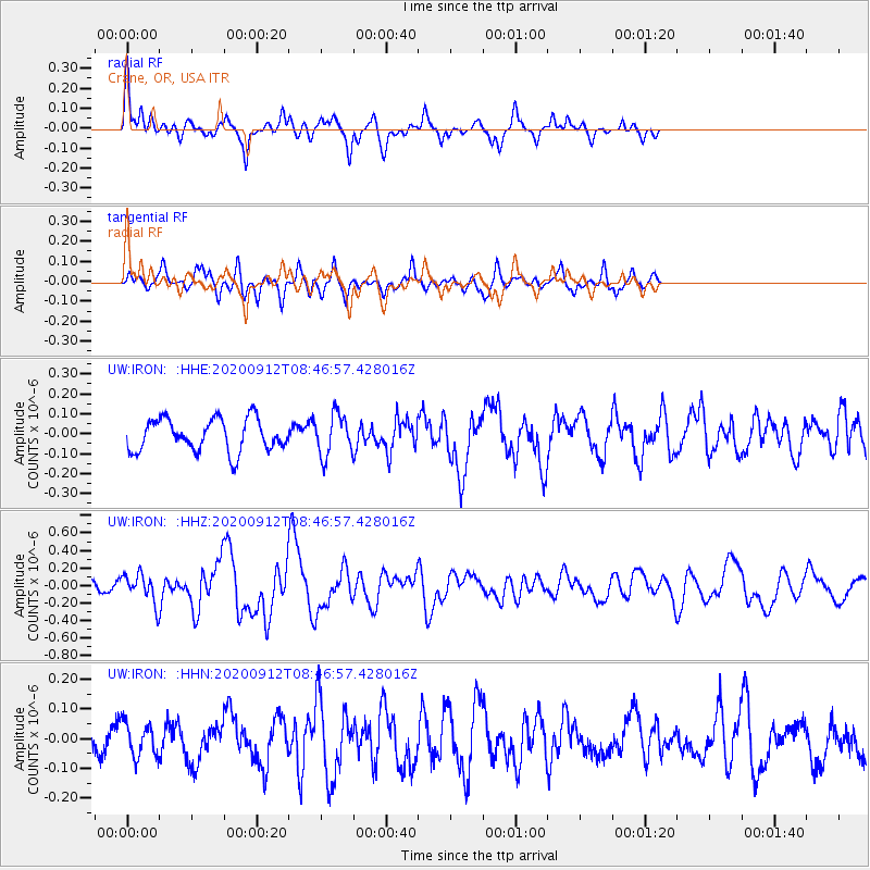
IRON Crane, OR, USA - Earthquake Result Viewer
*The percent match for this event was below the threshold and hence no stack was calculated.
| Earthquake location: |
Vanuatu Islands |
| Earthquake latitude/longitude: |
-17.3/167.7 |
| Earthquake time(UTC): |
2020/09/12 (256) 08:34:27 GMT |
| Earthquake Depth: |
10 km |
| Earthquake Magnitude: |
5.9 mww |
| Earthquake Catalog/Contributor: |
NEIC PDE/us |
|
| Network: |
UW Pacific Northwest Regional Seismic Network |
| Station: |
IRON Crane, OR, USA |
| Lat/Lon: |
43.36 N/118.47 W |
| Elevation: |
1226 m |
|
| Distance: |
90.4 deg |
| Az: |
44.471 deg |
| Baz: |
246.604 deg |
| Ray Param: |
$rayparam |
*The percent match for this event was below the threshold and hence was not used in the summary stack. |
|
| Radial Match: |
69.72448 % |
| Radial Bump: |
387 |
| Transverse Match: |
63.63856 % |
| Transverse Bump: |
386 |
| SOD ConfigId: |
22732711 |
| Insert Time: |
2020-09-26 08:49:58.698 +0000 |
| GWidth: |
2.5 |
| Max Bumps: |
400 |
| Tol: |
0.001 |
|
Signal To Noise
| Channel | StoN | STA | LTA |
| UW:IRON: :HHZ:20200912T08:46:57.428016Z | 1.9432617 | 1.5877879E-7 | 8.1707356E-8 |
| UW:IRON: :HHN:20200912T08:46:57.428016Z | 1.1226597 | 5.669407E-8 | 5.049978E-8 |
| UW:IRON: :HHE:20200912T08:46:57.428016Z | 1.2739482 | 1.0347973E-7 | 8.1227576E-8 |
| Arrivals |
| Ps | |
| PpPs | |
| PsPs/PpSs | |


