You are here: Home > Network List > WY - Yellowstone Wyoming Seismic Network Stations List
> Station YPP Pitchstone Plateau, YNP, WY, USA > Earthquake Result Viewer
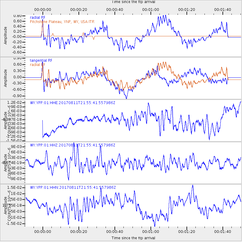
YPP Pitchstone Plateau, YNP, WY, USA - Earthquake Result Viewer
*The percent match for this event was below the threshold and hence no stack was calculated.
| Earthquake location: |
Near Coast Of Peru |
| Earthquake latitude/longitude: |
-16.3/-73.5 |
| Earthquake time(UTC): |
2017/08/11 (223) 21:45:09 GMT |
| Earthquake Depth: |
35 km |
| Earthquake Magnitude: |
5.6 Mww |
| Earthquake Catalog/Contributor: |
NEIC PDE/us |
|
| Network: |
WY Yellowstone Wyoming Seismic Network |
| Station: |
YPP Pitchstone Plateau, YNP, WY, USA |
| Lat/Lon: |
44.27 N/110.80 W |
| Elevation: |
2707 m |
|
| Distance: |
69.2 deg |
| Az: |
332.236 deg |
| Baz: |
141.486 deg |
| Ray Param: |
$rayparam |
*The percent match for this event was below the threshold and hence was not used in the summary stack. |
|
| Radial Match: |
38.60968 % |
| Radial Bump: |
400 |
| Transverse Match: |
39.432766 % |
| Transverse Bump: |
400 |
| SOD ConfigId: |
2140511 |
| Insert Time: |
2017-08-25 13:43:33.189 +0000 |
| GWidth: |
2.5 |
| Max Bumps: |
400 |
| Tol: |
0.001 |
|
Signal To Noise
| Channel | StoN | STA | LTA |
| WY:YPP:01:HHZ:20170811T21:55:41.557986Z | 2.2549942 | 3.0528136E-9 | 1.3538011E-9 |
| WY:YPP:01:HHN:20170811T21:55:41.557986Z | 0.74946463 | 3.991031E-9 | 5.3251763E-9 |
| WY:YPP:01:HHE:20170811T21:55:41.557986Z | 1.4166603 | 5.9424314E-9 | 4.194676E-9 |
| Arrivals |
| Ps | |
| PpPs | |
| PsPs/PpSs | |


