You are here: Home > Network List > CN - Canadian National Seismograph Network Stations List
> Station INK INUVIK, NT > Earthquake Result Viewer
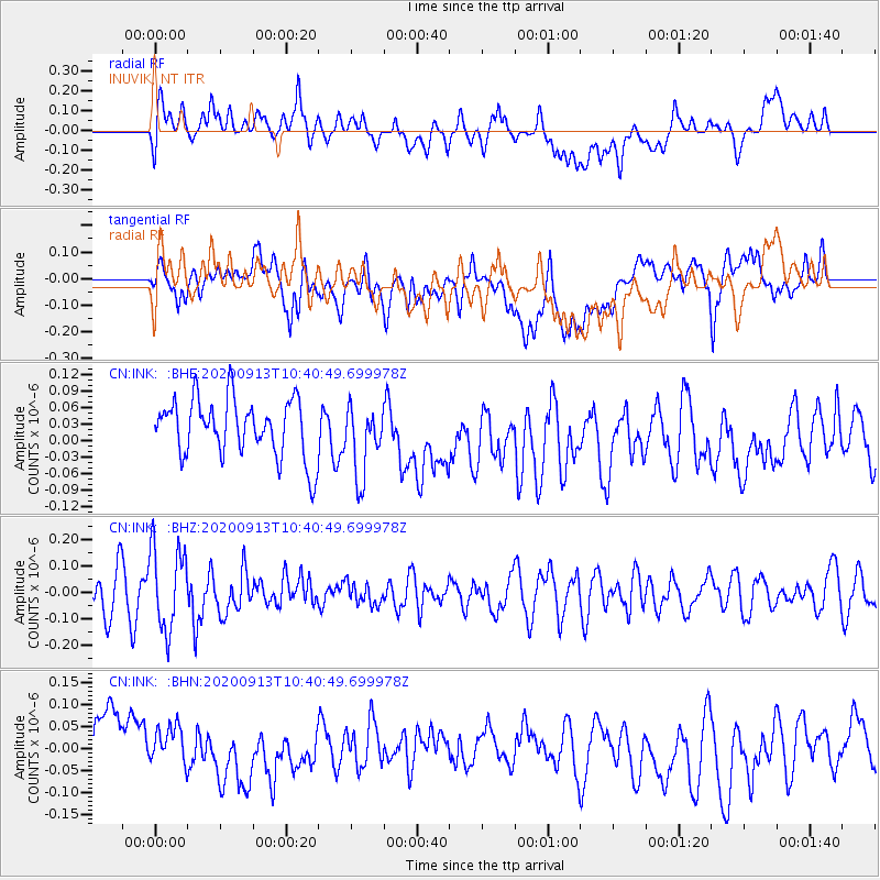
INK INUVIK, NT - Earthquake Result Viewer
*The percent match for this event was below the threshold and hence no stack was calculated.
| Earthquake location: |
Eastern New Guinea Reg., P.N.G. |
| Earthquake latitude/longitude: |
-6.0/147.0 |
| Earthquake time(UTC): |
2020/09/13 (257) 10:28:19 GMT |
| Earthquake Depth: |
56 km |
| Earthquake Magnitude: |
5.1 Mww |
| Earthquake Catalog/Contributor: |
NEIC PDE/us |
|
| Network: |
CN Canadian National Seismograph Network |
| Station: |
INK INUVIK, NT |
| Lat/Lon: |
68.31 N/133.53 W |
| Elevation: |
44 m |
|
| Distance: |
91.7 deg |
| Az: |
21.449 deg |
| Baz: |
258.0 deg |
| Ray Param: |
$rayparam |
*The percent match for this event was below the threshold and hence was not used in the summary stack. |
|
| Radial Match: |
57.308743 % |
| Radial Bump: |
400 |
| Transverse Match: |
44.259567 % |
| Transverse Bump: |
400 |
| SOD ConfigId: |
22732711 |
| Insert Time: |
2020-09-27 10:34:33.284 +0000 |
| GWidth: |
2.5 |
| Max Bumps: |
400 |
| Tol: |
0.001 |
|
Signal To Noise
| Channel | StoN | STA | LTA |
| CN:INK: :BHZ:20200913T10:40:49.699978Z | 2.1047351 | 1.5665842E-7 | 7.443141E-8 |
| CN:INK: :BHN:20200913T10:40:49.699978Z | 0.819289 | 6.7446E-8 | 8.23226E-8 |
| CN:INK: :BHE:20200913T10:40:49.699978Z | 1.2201524 | 6.405132E-8 | 5.2494524E-8 |
| Arrivals |
| Ps | |
| PpPs | |
| PsPs/PpSs | |


