You are here: Home > Network List > TA - USArray Transportable Network (new EarthScope stations) Stations List
> Station F20K Avaraart Lake, AK, USA > Earthquake Result Viewer
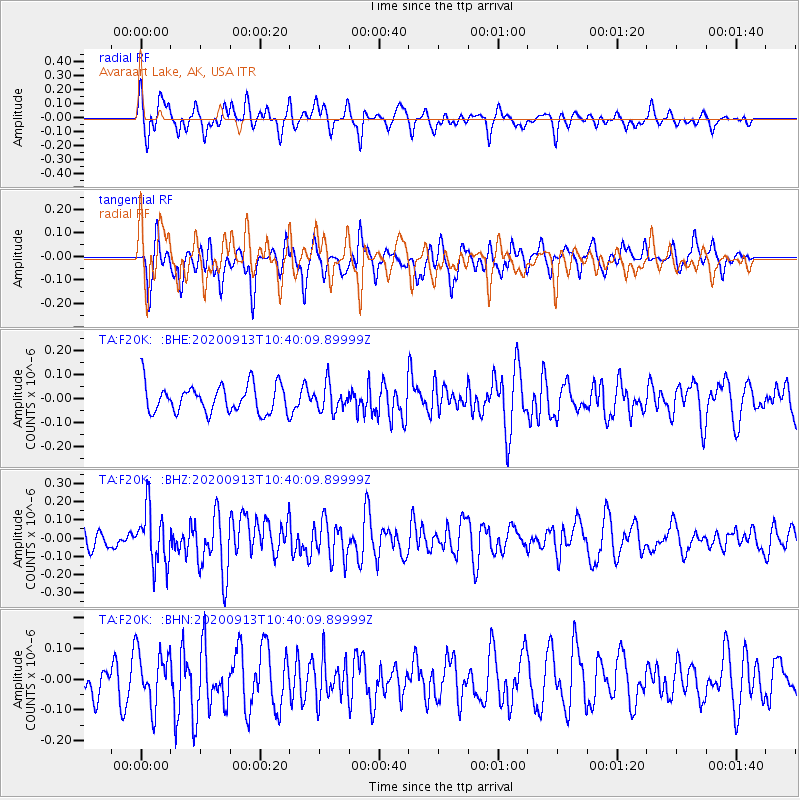
F20K Avaraart Lake, AK, USA - Earthquake Result Viewer
*The percent match for this event was below the threshold and hence no stack was calculated.
| Earthquake location: |
Eastern New Guinea Reg., P.N.G. |
| Earthquake latitude/longitude: |
-6.0/147.0 |
| Earthquake time(UTC): |
2020/09/13 (257) 10:28:19 GMT |
| Earthquake Depth: |
56 km |
| Earthquake Magnitude: |
5.1 Mww |
| Earthquake Catalog/Contributor: |
NEIC PDE/us |
|
| Network: |
TA USArray Transportable Network (new EarthScope stations) |
| Station: |
F20K Avaraart Lake, AK, USA |
| Lat/Lon: |
67.05 N/155.73 W |
| Elevation: |
136 m |
|
| Distance: |
83.4 deg |
| Az: |
19.393 deg |
| Baz: |
237.357 deg |
| Ray Param: |
$rayparam |
*The percent match for this event was below the threshold and hence was not used in the summary stack. |
|
| Radial Match: |
67.2097 % |
| Radial Bump: |
400 |
| Transverse Match: |
44.249767 % |
| Transverse Bump: |
343 |
| SOD ConfigId: |
22732711 |
| Insert Time: |
2020-09-27 10:38:27.788 +0000 |
| GWidth: |
2.5 |
| Max Bumps: |
400 |
| Tol: |
0.001 |
|
Signal To Noise
| Channel | StoN | STA | LTA |
| TA:F20K: :BHZ:20200913T10:40:09.89999Z | 2.5465963 | 1.5189055E-7 | 5.9644535E-8 |
| TA:F20K: :BHN:20200913T10:40:09.89999Z | 1.7474464 | 8.9065445E-8 | 5.096891E-8 |
| TA:F20K: :BHE:20200913T10:40:09.89999Z | 0.94520336 | 5.5057033E-8 | 5.8248876E-8 |
| Arrivals |
| Ps | |
| PpPs | |
| PsPs/PpSs | |


