You are here: Home > Network List > TA - USArray Transportable Network (new EarthScope stations) Stations List
> Station F26K Sheenjek River, AK, USA > Earthquake Result Viewer
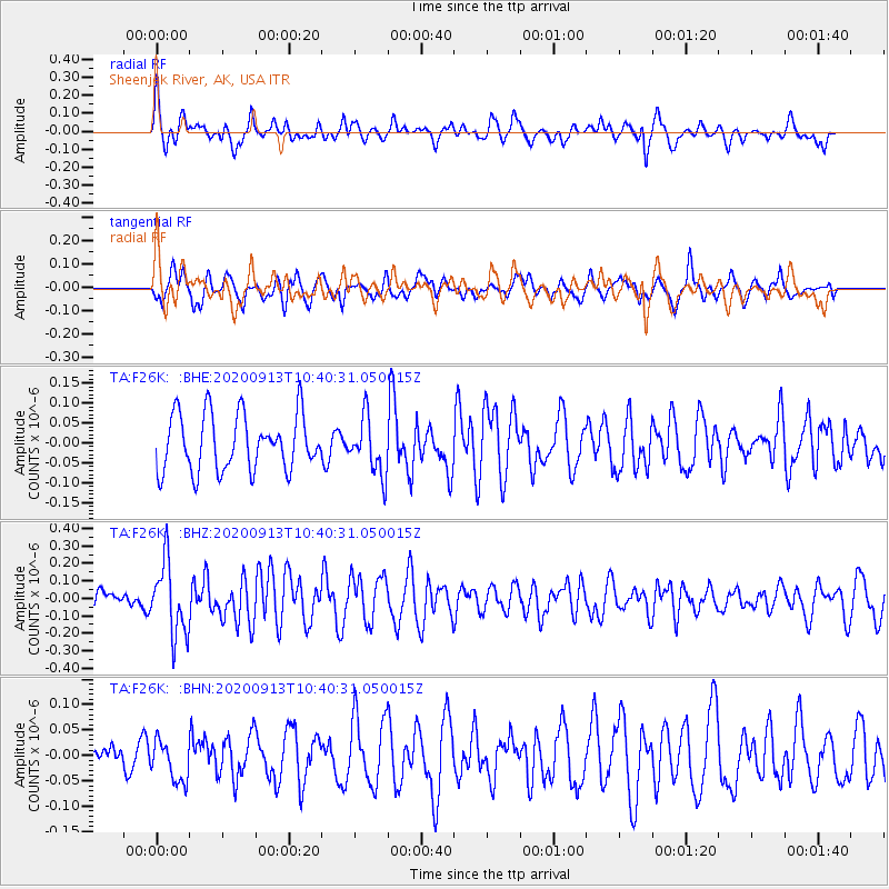
F26K Sheenjek River, AK, USA - Earthquake Result Viewer
*The percent match for this event was below the threshold and hence no stack was calculated.
| Earthquake location: |
Eastern New Guinea Reg., P.N.G. |
| Earthquake latitude/longitude: |
-6.0/147.0 |
| Earthquake time(UTC): |
2020/09/13 (257) 10:28:19 GMT |
| Earthquake Depth: |
56 km |
| Earthquake Magnitude: |
5.1 Mww |
| Earthquake Catalog/Contributor: |
NEIC PDE/us |
|
| Network: |
TA USArray Transportable Network (new EarthScope stations) |
| Station: |
F26K Sheenjek River, AK, USA |
| Lat/Lon: |
67.69 N/144.15 W |
| Elevation: |
683 m |
|
| Distance: |
87.7 deg |
| Az: |
20.872 deg |
| Baz: |
248.155 deg |
| Ray Param: |
$rayparam |
*The percent match for this event was below the threshold and hence was not used in the summary stack. |
|
| Radial Match: |
72.61942 % |
| Radial Bump: |
400 |
| Transverse Match: |
63.12054 % |
| Transverse Bump: |
400 |
| SOD ConfigId: |
22732711 |
| Insert Time: |
2020-09-27 10:38:32.344 +0000 |
| GWidth: |
2.5 |
| Max Bumps: |
400 |
| Tol: |
0.001 |
|
Signal To Noise
| Channel | StoN | STA | LTA |
| TA:F26K: :BHZ:20200913T10:40:31.050015Z | 2.8802218 | 2.0595627E-7 | 7.150709E-8 |
| TA:F26K: :BHN:20200913T10:40:31.050015Z | 1.2821407 | 4.0446206E-8 | 3.1545838E-8 |
| TA:F26K: :BHE:20200913T10:40:31.050015Z | 1.0080954 | 7.112555E-8 | 7.0554385E-8 |
| Arrivals |
| Ps | |
| PpPs | |
| PsPs/PpSs | |


