You are here: Home > Network List > GS - US Geological Survey Networks Stations List
> Station DEC05 Decatur Surface Seismic Site, Decatur, IL, USA > Earthquake Result Viewer
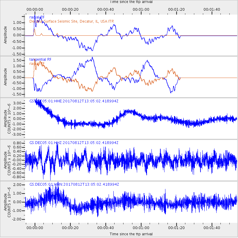
DEC05 Decatur Surface Seismic Site, Decatur, IL, USA - Earthquake Result Viewer
*The percent match for this event was below the threshold and hence no stack was calculated.
| Earthquake location: |
Off Coast Of Central Chile |
| Earthquake latitude/longitude: |
-30.2/-72.3 |
| Earthquake time(UTC): |
2017/08/12 (224) 12:54:12 GMT |
| Earthquake Depth: |
6.6 km |
| Earthquake Magnitude: |
5.8 Mww |
| Earthquake Catalog/Contributor: |
NEIC PDE/us |
|
| Network: |
GS US Geological Survey Networks |
| Station: |
DEC05 Decatur Surface Seismic Site, Decatur, IL, USA |
| Lat/Lon: |
39.87 N/88.87 W |
| Elevation: |
216 m |
|
| Distance: |
71.4 deg |
| Az: |
346.587 deg |
| Baz: |
164.88 deg |
| Ray Param: |
$rayparam |
*The percent match for this event was below the threshold and hence was not used in the summary stack. |
|
| Radial Match: |
19.161673 % |
| Radial Bump: |
400 |
| Transverse Match: |
16.78218 % |
| Transverse Bump: |
400 |
| SOD ConfigId: |
2140511 |
| Insert Time: |
2017-08-26 04:49:45.334 +0000 |
| GWidth: |
2.5 |
| Max Bumps: |
400 |
| Tol: |
0.001 |
|
Signal To Noise
| Channel | StoN | STA | LTA |
| GS:DEC05:01:HHZ:20170812T13:05:02.418994Z | 1.3069068 | 2.8578796E-7 | 2.1867508E-7 |
| GS:DEC05:01:HHN:20170812T13:05:02.418994Z | 0.8803641 | 5.904172E-7 | 6.7065116E-7 |
| GS:DEC05:01:HHE:20170812T13:05:02.418994Z | 1.0412726 | 1.5910117E-6 | 1.5279492E-6 |
| Arrivals |
| Ps | |
| PpPs | |
| PsPs/PpSs | |


