You are here: Home > Network List > TA - USArray Transportable Network (new EarthScope stations) Stations List
> Station R33M Jennings River, BC, CAN > Earthquake Result Viewer
R33M Jennings River, BC, CAN - Earthquake Result Viewer
*The percent match for this event was below the threshold and hence no stack was calculated.
| Earthquake location: |
Eastern New Guinea Reg., P.N.G. |
| Earthquake latitude/longitude: |
-6.0/147.0 |
| Earthquake time(UTC): |
2020/09/13 (257) 10:28:19 GMT |
| Earthquake Depth: |
56 km |
| Earthquake Magnitude: |
5.1 Mww |
| Earthquake Catalog/Contributor: |
NEIC PDE/us |
|
| Network: |
TA USArray Transportable Network (new EarthScope stations) |
| Station: |
R33M Jennings River, BC, CAN |
| Lat/Lon: |
59.39 N/130.97 W |
| Elevation: |
1437 m |
|
| Distance: |
91.1 deg |
| Az: |
30.45 deg |
| Baz: |
260.08 deg |
| Ray Param: |
$rayparam |
*The percent match for this event was below the threshold and hence was not used in the summary stack. |
|
| Radial Match: |
47.69967 % |
| Radial Bump: |
400 |
| Transverse Match: |
65.86914 % |
| Transverse Bump: |
400 |
| SOD ConfigId: |
22732711 |
| Insert Time: |
2020-09-27 10:39:36.581 +0000 |
| GWidth: |
2.5 |
| Max Bumps: |
400 |
| Tol: |
0.001 |
|
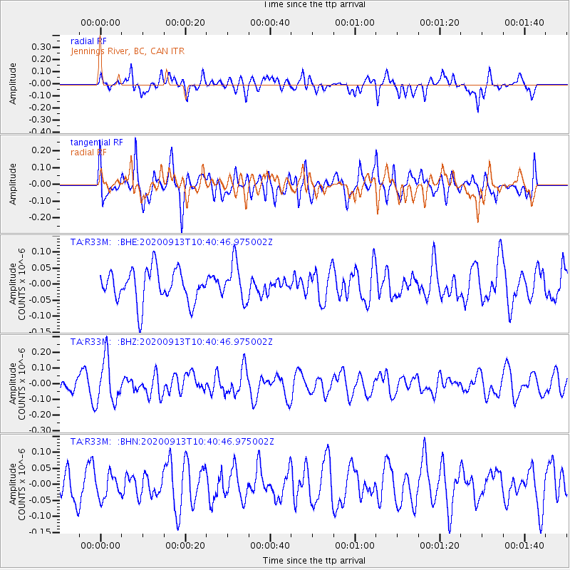
Signal To Noise
| Channel | StoN | STA | LTA |
| TA:R33M: :BHZ:20200913T10:40:46.975002Z | 2.778842 | 1.4174748E-7 | 5.100955E-8 |
| TA:R33M: :BHN:20200913T10:40:46.975002Z | 0.79449534 | 3.5735347E-8 | 4.4978677E-8 |
| TA:R33M: :BHE:20200913T10:40:46.975002Z | 1.205576 | 6.10092E-8 | 5.060586E-8 |
| Arrivals |
| Ps | |
| PpPs | |
| PsPs/PpSs | |


