You are here: Home > Network List > US - United States National Seismic Network Stations List
> Station HAWA Hanford, Washington, USA > Earthquake Result Viewer
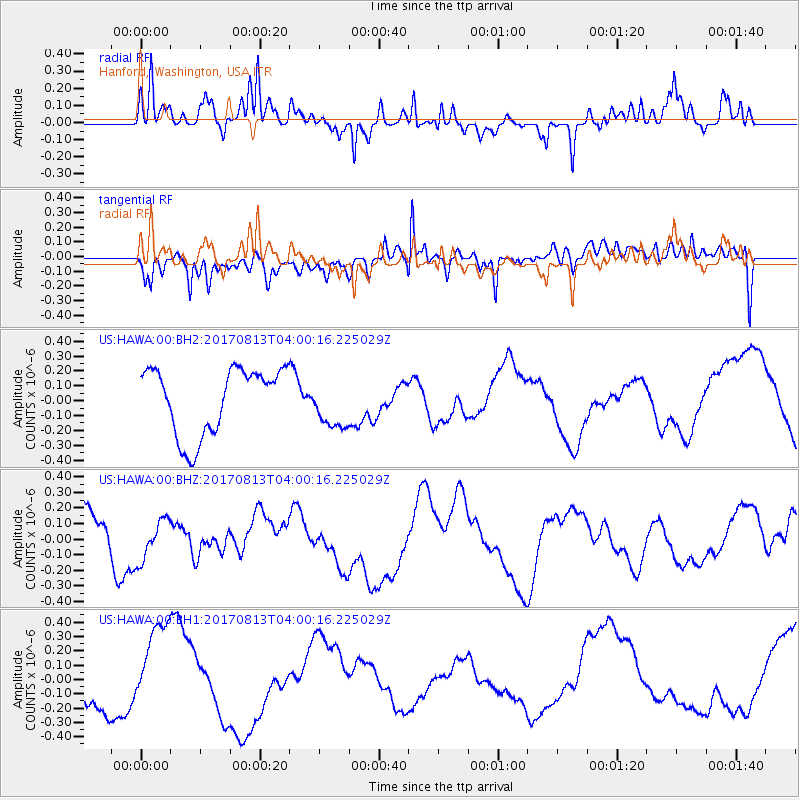
HAWA Hanford, Washington, USA - Earthquake Result Viewer
*The percent match for this event was below the threshold and hence no stack was calculated.
| Earthquake location: |
Solomon Islands |
| Earthquake latitude/longitude: |
-10.1/160.8 |
| Earthquake time(UTC): |
2017/08/13 (225) 03:47:50 GMT |
| Earthquake Depth: |
34 km |
| Earthquake Magnitude: |
5.0 mb |
| Earthquake Catalog/Contributor: |
NEIC PDE/us |
|
| Network: |
US United States National Seismic Network |
| Station: |
HAWA Hanford, Washington, USA |
| Lat/Lon: |
46.39 N/119.53 W |
| Elevation: |
364 m |
|
| Distance: |
90.1 deg |
| Az: |
42.907 deg |
| Baz: |
255.621 deg |
| Ray Param: |
$rayparam |
*The percent match for this event was below the threshold and hence was not used in the summary stack. |
|
| Radial Match: |
57.6439 % |
| Radial Bump: |
400 |
| Transverse Match: |
43.278324 % |
| Transverse Bump: |
400 |
| SOD ConfigId: |
2140511 |
| Insert Time: |
2017-08-26 19:41:07.713 +0000 |
| GWidth: |
2.5 |
| Max Bumps: |
400 |
| Tol: |
0.001 |
|
Signal To Noise
| Channel | StoN | STA | LTA |
| US:HAWA:00:BHZ:20170813T04:00:16.225029Z | 0.96847653 | 1.3088207E-7 | 1.3514222E-7 |
| US:HAWA:00:BH1:20170813T04:00:16.225029Z | 2.682253 | 3.237346E-7 | 1.2069503E-7 |
| US:HAWA:00:BH2:20170813T04:00:16.225029Z | 0.74532163 | 1.6630392E-7 | 2.2313041E-7 |
| Arrivals |
| Ps | |
| PpPs | |
| PsPs/PpSs | |


