You are here: Home > Network List > TA - USArray Transportable Network (new EarthScope stations) Stations List
> Station I30M Mount Dempster, Yukon, CAN > Earthquake Result Viewer
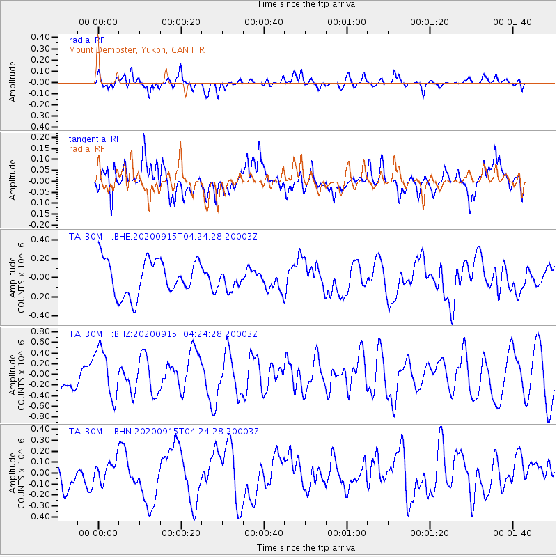
I30M Mount Dempster, Yukon, CAN - Earthquake Result Viewer
*The percent match for this event was below the threshold and hence no stack was calculated.
| Earthquake location: |
Fiji Islands |
| Earthquake latitude/longitude: |
-15.1/179.9 |
| Earthquake time(UTC): |
2020/09/15 (259) 04:12:16 GMT |
| Earthquake Depth: |
10 km |
| Earthquake Magnitude: |
6.0 Mww |
| Earthquake Catalog/Contributor: |
NEIC PDE/us |
|
| Network: |
TA USArray Transportable Network (new EarthScope stations) |
| Station: |
I30M Mount Dempster, Yukon, CAN |
| Lat/Lon: |
65.22 N/136.38 W |
| Elevation: |
1399 m |
|
| Distance: |
86.6 deg |
| Az: |
16.952 deg |
| Baz: |
221.936 deg |
| Ray Param: |
$rayparam |
*The percent match for this event was below the threshold and hence was not used in the summary stack. |
|
| Radial Match: |
41.28877 % |
| Radial Bump: |
400 |
| Transverse Match: |
64.68497 % |
| Transverse Bump: |
400 |
| SOD ConfigId: |
22732711 |
| Insert Time: |
2020-09-29 04:31:51.501 +0000 |
| GWidth: |
2.5 |
| Max Bumps: |
400 |
| Tol: |
0.001 |
|
Signal To Noise
| Channel | StoN | STA | LTA |
| TA:I30M: :BHZ:20200915T04:24:28.20003Z | 2.9984906 | 4.657955E-7 | 1.5534332E-7 |
| TA:I30M: :BHN:20200915T04:24:28.20003Z | 0.57899517 | 1.0045815E-7 | 1.735043E-7 |
| TA:I30M: :BHE:20200915T04:24:28.20003Z | 0.52495074 | 9.85377E-8 | 1.8770845E-7 |
| Arrivals |
| Ps | |
| PpPs | |
| PsPs/PpSs | |


