You are here: Home > Network List > CI - Caltech Regional Seismic Network Stations List
> Station MPP McPhearson Peak > Earthquake Result Viewer
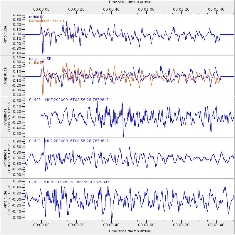
MPP McPhearson Peak - Earthquake Result Viewer
*The percent match for this event was below the threshold and hence no stack was calculated.
| Earthquake location: |
Southeast Of Loyalty Islands |
| Earthquake latitude/longitude: |
-22.3/171.5 |
| Earthquake time(UTC): |
2020/09/16 (260) 08:44:30 GMT |
| Earthquake Depth: |
119 km |
| Earthquake Magnitude: |
5.6 Mww |
| Earthquake Catalog/Contributor: |
NEIC PDE/us |
|
| Network: |
CI Caltech Regional Seismic Network |
| Station: |
MPP McPhearson Peak |
| Lat/Lon: |
34.89 N/119.81 W |
| Elevation: |
1739 m |
|
| Distance: |
86.5 deg |
| Az: |
50.112 deg |
| Baz: |
239.797 deg |
| Ray Param: |
$rayparam |
*The percent match for this event was below the threshold and hence was not used in the summary stack. |
|
| Radial Match: |
48.01432 % |
| Radial Bump: |
400 |
| Transverse Match: |
59.270336 % |
| Transverse Bump: |
400 |
| SOD ConfigId: |
22732711 |
| Insert Time: |
2020-09-30 08:51:27.325 +0000 |
| GWidth: |
2.5 |
| Max Bumps: |
400 |
| Tol: |
0.001 |
|
Signal To Noise
| Channel | StoN | STA | LTA |
| CI:MPP: :HHZ:20200916T08:56:28.787984Z | 2.194941 | 3.7774507E-7 | 1.7209804E-7 |
| CI:MPP: :HHN:20200916T08:56:28.787984Z | 1.2101887 | 2.3409903E-7 | 1.9344009E-7 |
| CI:MPP: :HHE:20200916T08:56:28.787984Z | 1.4794309 | 2.3485241E-7 | 1.587451E-7 |
| Arrivals |
| Ps | |
| PpPs | |
| PsPs/PpSs | |


