You are here: Home > Network List > CI - Caltech Regional Seismic Network Stations List
> Station SMM Simmler, CA, USA > Earthquake Result Viewer
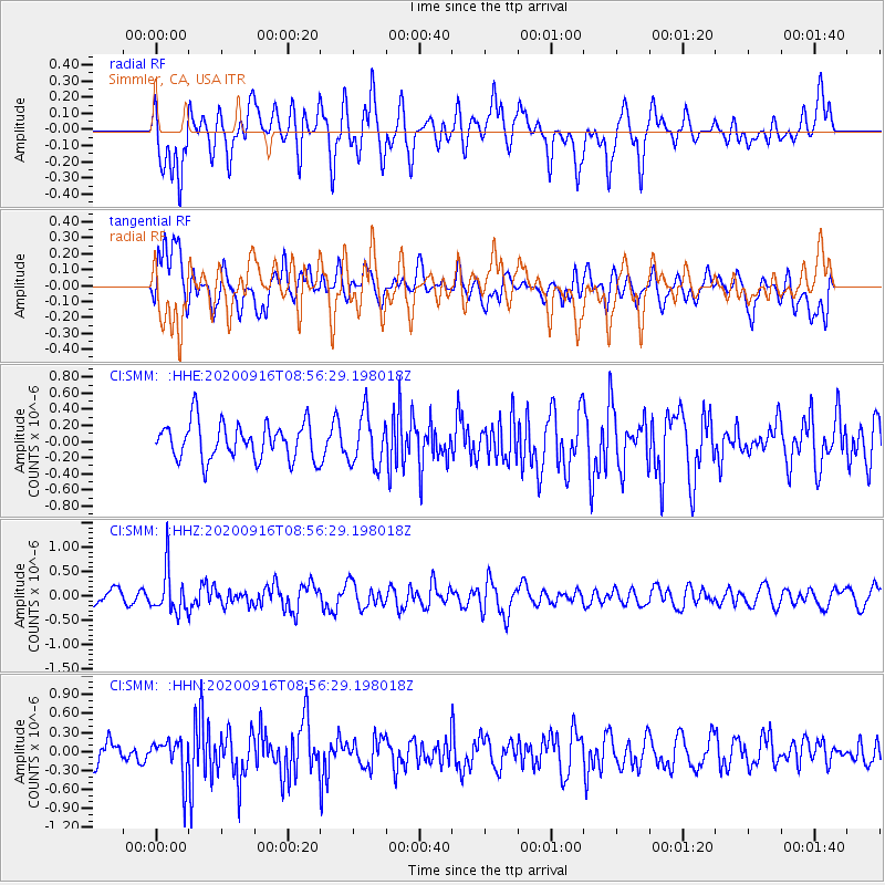
SMM Simmler, CA, USA - Earthquake Result Viewer
*The percent match for this event was below the threshold and hence no stack was calculated.
| Earthquake location: |
Southeast Of Loyalty Islands |
| Earthquake latitude/longitude: |
-22.3/171.5 |
| Earthquake time(UTC): |
2020/09/16 (260) 08:44:30 GMT |
| Earthquake Depth: |
119 km |
| Earthquake Magnitude: |
5.6 Mww |
| Earthquake Catalog/Contributor: |
NEIC PDE/us |
|
| Network: |
CI Caltech Regional Seismic Network |
| Station: |
SMM Simmler, CA, USA |
| Lat/Lon: |
35.31 N/120.00 W |
| Elevation: |
599 m |
|
| Distance: |
86.6 deg |
| Az: |
49.669 deg |
| Baz: |
239.665 deg |
| Ray Param: |
$rayparam |
*The percent match for this event was below the threshold and hence was not used in the summary stack. |
|
| Radial Match: |
64.56193 % |
| Radial Bump: |
400 |
| Transverse Match: |
57.625664 % |
| Transverse Bump: |
400 |
| SOD ConfigId: |
22732711 |
| Insert Time: |
2020-09-30 08:51:51.600 +0000 |
| GWidth: |
2.5 |
| Max Bumps: |
400 |
| Tol: |
0.001 |
|
Signal To Noise
| Channel | StoN | STA | LTA |
| CI:SMM: :HHZ:20200916T08:56:29.198018Z | 3.073634 | 4.423767E-7 | 1.4392627E-7 |
| CI:SMM: :HHN:20200916T08:56:29.198018Z | 1.5526516 | 3.120695E-7 | 2.0099131E-7 |
| CI:SMM: :HHE:20200916T08:56:29.198018Z | 1.3917304 | 3.1655298E-7 | 2.2745279E-7 |
| Arrivals |
| Ps | |
| PpPs | |
| PsPs/PpSs | |


