You are here: Home > Network List > TA - USArray Transportable Network (new EarthScope stations) Stations List
> Station E20K Nigu River, AK, USA > Earthquake Result Viewer
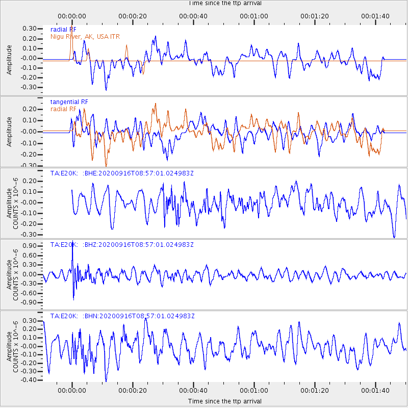
E20K Nigu River, AK, USA - Earthquake Result Viewer
*The percent match for this event was below the threshold and hence no stack was calculated.
| Earthquake location: |
Southeast Of Loyalty Islands |
| Earthquake latitude/longitude: |
-22.3/171.5 |
| Earthquake time(UTC): |
2020/09/16 (260) 08:44:30 GMT |
| Earthquake Depth: |
119 km |
| Earthquake Magnitude: |
5.6 Mww |
| Earthquake Catalog/Contributor: |
NEIC PDE/us |
|
| Network: |
TA USArray Transportable Network (new EarthScope stations) |
| Station: |
E20K Nigu River, AK, USA |
| Lat/Lon: |
68.26 N/156.19 W |
| Elevation: |
866 m |
|
| Distance: |
93.4 deg |
| Az: |
11.508 deg |
| Baz: |
209.722 deg |
| Ray Param: |
$rayparam |
*The percent match for this event was below the threshold and hence was not used in the summary stack. |
|
| Radial Match: |
45.483967 % |
| Radial Bump: |
400 |
| Transverse Match: |
35.71154 % |
| Transverse Bump: |
400 |
| SOD ConfigId: |
22732711 |
| Insert Time: |
2020-09-30 08:56:52.110 +0000 |
| GWidth: |
2.5 |
| Max Bumps: |
400 |
| Tol: |
0.001 |
|
Signal To Noise
| Channel | StoN | STA | LTA |
| TA:E20K: :BHZ:20200916T08:57:01.024983Z | 2.5955129 | 3.144187E-7 | 1.2113934E-7 |
| TA:E20K: :BHN:20200916T08:57:01.024983Z | 1.1638514 | 1.5618922E-7 | 1.3420032E-7 |
| TA:E20K: :BHE:20200916T08:57:01.024983Z | 1.154963 | 1.10163334E-7 | 9.538256E-8 |
| Arrivals |
| Ps | |
| PpPs | |
| PsPs/PpSs | |


