You are here: Home > Network List > TA - USArray Transportable Network (new EarthScope stations) Stations List
> Station G23K Bananza Creek, AK, USA > Earthquake Result Viewer
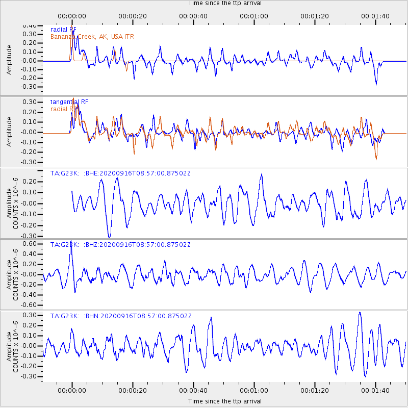
G23K Bananza Creek, AK, USA - Earthquake Result Viewer
*The percent match for this event was below the threshold and hence no stack was calculated.
| Earthquake location: |
Southeast Of Loyalty Islands |
| Earthquake latitude/longitude: |
-22.3/171.5 |
| Earthquake time(UTC): |
2020/09/16 (260) 08:44:30 GMT |
| Earthquake Depth: |
119 km |
| Earthquake Magnitude: |
5.6 Mww |
| Earthquake Catalog/Contributor: |
NEIC PDE/us |
|
| Network: |
TA USArray Transportable Network (new EarthScope stations) |
| Station: |
G23K Bananza Creek, AK, USA |
| Lat/Lon: |
66.71 N/150.02 W |
| Elevation: |
746 m |
|
| Distance: |
93.3 deg |
| Az: |
14.348 deg |
| Baz: |
215.246 deg |
| Ray Param: |
$rayparam |
*The percent match for this event was below the threshold and hence was not used in the summary stack. |
|
| Radial Match: |
56.02846 % |
| Radial Bump: |
400 |
| Transverse Match: |
55.40607 % |
| Transverse Bump: |
400 |
| SOD ConfigId: |
22732711 |
| Insert Time: |
2020-09-30 08:57:05.848 +0000 |
| GWidth: |
2.5 |
| Max Bumps: |
400 |
| Tol: |
0.001 |
|
Signal To Noise
| Channel | StoN | STA | LTA |
| TA:G23K: :BHZ:20200916T08:57:00.87502Z | 3.0923266 | 2.519366E-7 | 8.147153E-8 |
| TA:G23K: :BHN:20200916T08:57:00.87502Z | 0.94922024 | 7.933877E-8 | 8.3583096E-8 |
| TA:G23K: :BHE:20200916T08:57:00.87502Z | 0.44421497 | 5.4328396E-8 | 1.2230204E-7 |
| Arrivals |
| Ps | |
| PpPs | |
| PsPs/PpSs | |


