You are here: Home > Network List > TA - USArray Transportable Network (new EarthScope stations) Stations List
> Station M31M Drury Creek, Yukon, CA > Earthquake Result Viewer
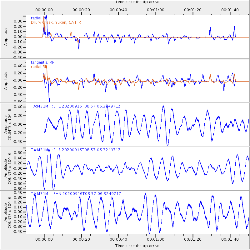
M31M Drury Creek, Yukon, CA - Earthquake Result Viewer
*The percent match for this event was below the threshold and hence no stack was calculated.
| Earthquake location: |
Southeast Of Loyalty Islands |
| Earthquake latitude/longitude: |
-22.3/171.5 |
| Earthquake time(UTC): |
2020/09/16 (260) 08:44:30 GMT |
| Earthquake Depth: |
119 km |
| Earthquake Magnitude: |
5.6 Mww |
| Earthquake Catalog/Contributor: |
NEIC PDE/us |
|
| Network: |
TA USArray Transportable Network (new EarthScope stations) |
| Station: |
M31M Drury Creek, Yukon, CA |
| Lat/Lon: |
62.20 N/134.39 W |
| Elevation: |
639 m |
|
| Distance: |
94.5 deg |
| Az: |
22.395 deg |
| Baz: |
228.807 deg |
| Ray Param: |
$rayparam |
*The percent match for this event was below the threshold and hence was not used in the summary stack. |
|
| Radial Match: |
83.51475 % |
| Radial Bump: |
400 |
| Transverse Match: |
62.064274 % |
| Transverse Bump: |
400 |
| SOD ConfigId: |
22732711 |
| Insert Time: |
2020-09-30 08:57:35.972 +0000 |
| GWidth: |
2.5 |
| Max Bumps: |
400 |
| Tol: |
0.001 |
|
Signal To Noise
| Channel | StoN | STA | LTA |
| TA:M31M: :BHZ:20200916T08:57:06.324971Z | 2.0265265 | 5.380656E-7 | 2.655113E-7 |
| TA:M31M: :BHN:20200916T08:57:06.324971Z | 0.8760012 | 1.9986554E-7 | 2.2815671E-7 |
| TA:M31M: :BHE:20200916T08:57:06.324971Z | 1.530111 | 2.8532156E-7 | 1.8647115E-7 |
| Arrivals |
| Ps | |
| PpPs | |
| PsPs/PpSs | |


