You are here: Home > Network List > TA - USArray Transportable Network (new EarthScope stations) Stations List
> Station O17K Koliganek, Bristol Bay, AK, USA > Earthquake Result Viewer
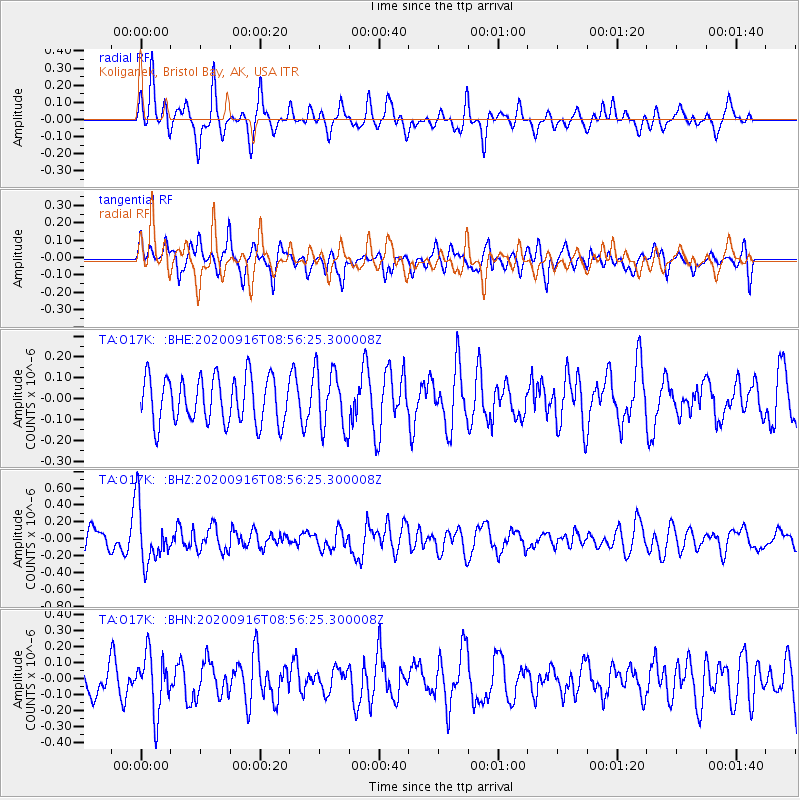
O17K Koliganek, Bristol Bay, AK, USA - Earthquake Result Viewer
*The percent match for this event was below the threshold and hence no stack was calculated.
| Earthquake location: |
Southeast Of Loyalty Islands |
| Earthquake latitude/longitude: |
-22.3/171.5 |
| Earthquake time(UTC): |
2020/09/16 (260) 08:44:30 GMT |
| Earthquake Depth: |
119 km |
| Earthquake Magnitude: |
5.6 Mww |
| Earthquake Catalog/Contributor: |
NEIC PDE/us |
|
| Network: |
TA USArray Transportable Network (new EarthScope stations) |
| Station: |
O17K Koliganek, Bristol Bay, AK, USA |
| Lat/Lon: |
59.77 N/157.09 W |
| Elevation: |
156 m |
|
| Distance: |
85.8 deg |
| Az: |
15.33 deg |
| Baz: |
208.936 deg |
| Ray Param: |
$rayparam |
*The percent match for this event was below the threshold and hence was not used in the summary stack. |
|
| Radial Match: |
65.30373 % |
| Radial Bump: |
400 |
| Transverse Match: |
55.27765 % |
| Transverse Bump: |
389 |
| SOD ConfigId: |
22732711 |
| Insert Time: |
2020-09-30 08:57:44.885 +0000 |
| GWidth: |
2.5 |
| Max Bumps: |
400 |
| Tol: |
0.001 |
|
Signal To Noise
| Channel | StoN | STA | LTA |
| TA:O17K: :BHZ:20200916T08:56:25.300008Z | 3.053005 | 3.3778983E-7 | 1.1064176E-7 |
| TA:O17K: :BHN:20200916T08:56:25.300008Z | 2.0639753 | 1.8052802E-7 | 8.746617E-8 |
| TA:O17K: :BHE:20200916T08:56:25.300008Z | 1.3204677 | 1.4498791E-7 | 1.09800425E-7 |
| Arrivals |
| Ps | |
| PpPs | |
| PsPs/PpSs | |


