You are here: Home > Network List > US - United States National Seismic Network Stations List
> Station DGMT Dagmar, Montana, USA > Earthquake Result Viewer
DGMT Dagmar, Montana, USA - Earthquake Result Viewer
*The percent match for this event was below the threshold and hence no stack was calculated.
| Earthquake location: |
Central Peru |
| Earthquake latitude/longitude: |
-10.7/-74.6 |
| Earthquake time(UTC): |
2017/08/13 (225) 16:51:22 GMT |
| Earthquake Depth: |
21 km |
| Earthquake Magnitude: |
5.6 mb |
| Earthquake Catalog/Contributor: |
NEIC PDE/us |
|
| Network: |
US United States National Seismic Network |
| Station: |
DGMT Dagmar, Montana, USA |
| Lat/Lon: |
48.47 N/104.20 W |
| Elevation: |
0.0 m |
|
| Distance: |
64.5 deg |
| Az: |
338.619 deg |
| Baz: |
147.425 deg |
| Ray Param: |
$rayparam |
*The percent match for this event was below the threshold and hence was not used in the summary stack. |
|
| Radial Match: |
51.124996 % |
| Radial Bump: |
400 |
| Transverse Match: |
48.648605 % |
| Transverse Bump: |
400 |
| SOD ConfigId: |
2140511 |
| Insert Time: |
2017-08-27 08:52:41.299 +0000 |
| GWidth: |
2.5 |
| Max Bumps: |
400 |
| Tol: |
0.001 |
|
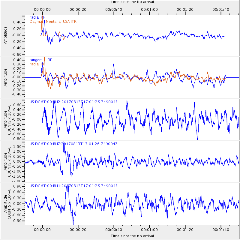
Signal To Noise
| Channel | StoN | STA | LTA |
| US:DGMT:00:BHZ:20170813T17:01:26.749004Z | 3.7695584 | 3.2447826E-7 | 8.6078586E-8 |
| US:DGMT:00:BH1:20170813T17:01:26.749004Z | 0.96223027 | 2.1147301E-7 | 2.1977381E-7 |
| US:DGMT:00:BH2:20170813T17:01:26.749004Z | 0.6287298 | 2.3756542E-7 | 3.7784977E-7 |
| Arrivals |
| Ps | |
| PpPs | |
| PsPs/PpSs | |


