You are here: Home > Network List > CI - Caltech Regional Seismic Network Stations List
> Station BFS Mt Baldy Forest Station > Earthquake Result Viewer
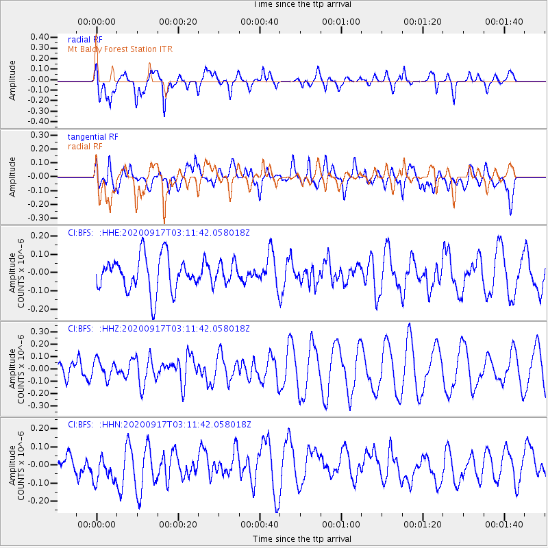
BFS Mt Baldy Forest Station - Earthquake Result Viewer
*The percent match for this event was below the threshold and hence no stack was calculated.
| Earthquake location: |
Central Mid-Atlantic Ridge |
| Earthquake latitude/longitude: |
8.0/-37.0 |
| Earthquake time(UTC): |
2020/09/17 (261) 03:00:15 GMT |
| Earthquake Depth: |
10 km |
| Earthquake Magnitude: |
5.7 Mww |
| Earthquake Catalog/Contributor: |
NEIC PDE/us |
|
| Network: |
CI Caltech Regional Seismic Network |
| Station: |
BFS Mt Baldy Forest Station |
| Lat/Lon: |
34.24 N/117.66 W |
| Elevation: |
1312 m |
|
| Distance: |
77.8 deg |
| Az: |
303.261 deg |
| Baz: |
88.592 deg |
| Ray Param: |
$rayparam |
*The percent match for this event was below the threshold and hence was not used in the summary stack. |
|
| Radial Match: |
65.392494 % |
| Radial Bump: |
400 |
| Transverse Match: |
50.27807 % |
| Transverse Bump: |
400 |
| SOD ConfigId: |
22732711 |
| Insert Time: |
2020-10-01 03:05:41.089 +0000 |
| GWidth: |
2.5 |
| Max Bumps: |
400 |
| Tol: |
0.001 |
|
Signal To Noise
| Channel | StoN | STA | LTA |
| CI:BFS: :HHZ:20200917T03:11:42.058018Z | 0.8784776 | 7.339477E-8 | 8.354769E-8 |
| CI:BFS: :HHN:20200917T03:11:42.058018Z | 1.3254489 | 9.236193E-8 | 6.968351E-8 |
| CI:BFS: :HHE:20200917T03:11:42.058018Z | 0.5647464 | 5.3485525E-8 | 9.470716E-8 |
| Arrivals |
| Ps | |
| PpPs | |
| PsPs/PpSs | |


