You are here: Home > Network List > TA - USArray Transportable Network (new EarthScope stations) Stations List
> Station I30M Mount Dempster, Yukon, CAN > Earthquake Result Viewer
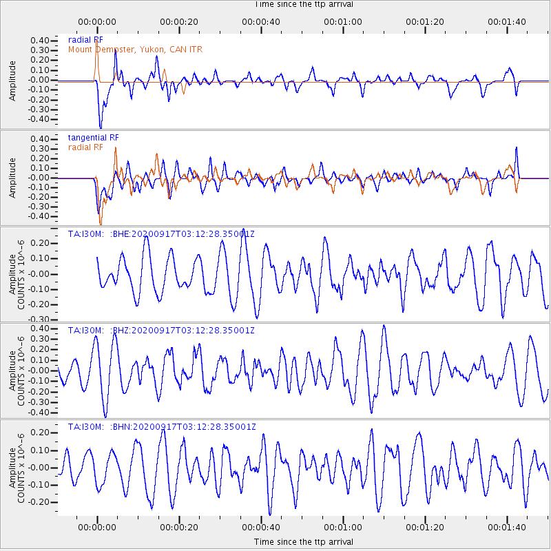
I30M Mount Dempster, Yukon, CAN - Earthquake Result Viewer
*The percent match for this event was below the threshold and hence no stack was calculated.
| Earthquake location: |
Central Mid-Atlantic Ridge |
| Earthquake latitude/longitude: |
8.0/-37.0 |
| Earthquake time(UTC): |
2020/09/17 (261) 03:00:15 GMT |
| Earthquake Depth: |
10 km |
| Earthquake Magnitude: |
5.7 Mww |
| Earthquake Catalog/Contributor: |
NEIC PDE/us |
|
| Network: |
TA USArray Transportable Network (new EarthScope stations) |
| Station: |
I30M Mount Dempster, Yukon, CAN |
| Lat/Lon: |
65.22 N/136.38 W |
| Elevation: |
1399 m |
|
| Distance: |
86.7 deg |
| Az: |
335.387 deg |
| Baz: |
78.197 deg |
| Ray Param: |
$rayparam |
*The percent match for this event was below the threshold and hence was not used in the summary stack. |
|
| Radial Match: |
82.21277 % |
| Radial Bump: |
400 |
| Transverse Match: |
52.393326 % |
| Transverse Bump: |
400 |
| SOD ConfigId: |
22732711 |
| Insert Time: |
2020-10-01 03:16:14.661 +0000 |
| GWidth: |
2.5 |
| Max Bumps: |
400 |
| Tol: |
0.001 |
|
Signal To Noise
| Channel | StoN | STA | LTA |
| TA:I30M: :BHZ:20200917T03:12:28.35001Z | 2.2558148 | 2.8570614E-7 | 1.2665318E-7 |
| TA:I30M: :BHN:20200917T03:12:28.35001Z | 0.7559776 | 8.619288E-8 | 1.1401512E-7 |
| TA:I30M: :BHE:20200917T03:12:28.35001Z | 1.4427823 | 1.5576767E-7 | 1.07963395E-7 |
| Arrivals |
| Ps | |
| PpPs | |
| PsPs/PpSs | |


