You are here: Home > Network List > TA - USArray Transportable Network (new EarthScope stations) Stations List
> Station O17K Koliganek, Bristol Bay, AK, USA > Earthquake Result Viewer
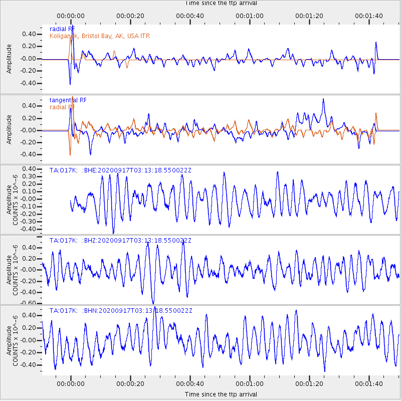
O17K Koliganek, Bristol Bay, AK, USA - Earthquake Result Viewer
*The percent match for this event was below the threshold and hence no stack was calculated.
| Earthquake location: |
Central Mid-Atlantic Ridge |
| Earthquake latitude/longitude: |
8.0/-37.0 |
| Earthquake time(UTC): |
2020/09/17 (261) 03:00:15 GMT |
| Earthquake Depth: |
10 km |
| Earthquake Magnitude: |
5.7 Mww |
| Earthquake Catalog/Contributor: |
NEIC PDE/us |
|
| Network: |
TA USArray Transportable Network (new EarthScope stations) |
| Station: |
O17K Koliganek, Bristol Bay, AK, USA |
| Lat/Lon: |
59.77 N/157.09 W |
| Elevation: |
156 m |
|
| Distance: |
97.6 deg |
| Az: |
333.788 deg |
| Baz: |
59.844 deg |
| Ray Param: |
$rayparam |
*The percent match for this event was below the threshold and hence was not used in the summary stack. |
|
| Radial Match: |
63.680252 % |
| Radial Bump: |
400 |
| Transverse Match: |
45.656357 % |
| Transverse Bump: |
400 |
| SOD ConfigId: |
22732711 |
| Insert Time: |
2020-10-01 03:16:25.279 +0000 |
| GWidth: |
2.5 |
| Max Bumps: |
400 |
| Tol: |
0.001 |
|
Signal To Noise
| Channel | StoN | STA | LTA |
| TA:O17K: :BHZ:20200917T03:13:18.550022Z | 0.83880705 | 1.2493301E-7 | 1.489413E-7 |
| TA:O17K: :BHN:20200917T03:13:18.550022Z | 1.4802443 | 2.6129334E-7 | 1.7652042E-7 |
| TA:O17K: :BHE:20200917T03:13:18.550022Z | 0.861379 | 1.4486504E-7 | 1.6817805E-7 |
| Arrivals |
| Ps | |
| PpPs | |
| PsPs/PpSs | |


